Off the Beaten Path Arizona: The Ultimate Guide to 100+ Hidden Gems (2026)
Off The Beaten Path Arizona
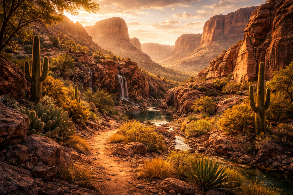
Discover the secret side of Arizona beyond the Grand Canyon—from hidden waterfalls and secret hot springs to ghost towns, ancient ruins, and wilderness adventures few tourists ever find
Arizona’s iconic attractions—the Grand Canyon, Sedona’s red rocks, Monument Valley—attract millions of visitors annually. But beyond these famous destinations lies another Arizona: a vast landscape of hidden canyons, forgotten historic sites, secret swimming holes, remote wilderness areas, and stunning natural wonders that most travelers never discover.
This comprehensive guide reveals over 100 off-the-beaten-path destinations across Arizona, organized by region and experience type. Whether you’re seeking solitude in nature, unique photo opportunities, historical exploration, or true wilderness adventure, you’ll find hidden gems that deliver authentic Arizona experiences without the crowds.
Table Of Contents
Part I: Understanding Off the Beaten Path Arizona
- What Makes a Destination “Off the Beaten Path“?
- How to Explore Responsibly
- Essential Preparation and Safety
- Best Times to Visit Hidden Arizona
Part II: Hidden Gems by Region
- Northern Arizona’s Secret Places
- Central Arizona’s Unknown Treasures
- Southern Arizona’s Hidden Wonders
- Eastern Arizona’s Forgotten Landscapes
- Western Arizona’s Remote Discoveries
Part III: Hidden Gems by Experience Type
- Secret Swimming Holes and Waterfalls
- Hidden Hot Springs and Thermal Pools
- Unknown Slot Canyons and Rock Formations
- Off-the-Radar Ghost Towns and Historic Sites
- Remote Hiking and Backpacking Destinations
- Secret Scenic Drives and Overlooks
- Hidden Ancient Ruins and Petroglyphs
- Undiscovered Wildlife Viewing Areas
- Lesser-Known Camping and Stargazing Spots
Part IV: Advanced Planning
- Creating Your Off the Beaten Path Itinerary
- Resources and Tools for Finding Hidden Gems
- Seasonal Considerations
- Frequently Asked Questions
Part I: Understanding Off the Beaten Path Ariona
What Makes a Destination “Off the Beaten Path”?
Not every quiet location qualifies as truly “off the beaten path.” For this guide, we define hidden Arizona destinations by these criteria:
Low visitation numbers. These places see fewer than 50,000 annual visitors (compared to Grand Canyon’s 4.7 million or Sedona’s 3+ million). Many receive just hundreds or thousands of yearly guests.
Difficult access or limited awareness. Hidden gems typically require dirt roads, hiking, local knowledge, or simply aren’t promoted through mainstream tourism channels.
Authentic experiences over tourist infrastructure. You won’t find gift shops, tour buses, or designated selfie spots. These locations reward exploration with genuine discovery.
Natural preservation and solitude. Off-the-beaten-path destinations allow you to experience Arizona’s landscapes, history, and wildlife without crowds competing for views or disrupting natural quiet.
Arizona’s massive size (6th largest state) and varied terrain—from Sonoran desert to alpine forests—create endless opportunities for hidden discoveries. Over 70% of Arizona is public land managed by federal and state agencies, offering access to millions of acres where few people venture.
This guide excludes:
- Major national parks and monuments (Grand Canyon, Saguaro, etc.)
- Popular Sedona vortex sites and trailheads
- Heavily visited Phoenix metro attractions
- Mainstream Tucson destinations
- Well-known Colorado River recreation areas
This guide includes:
- Remote corners of lesser-visited national monuments
- Hidden trails in national forests
- Secret BLM lands few know about
- Small state parks with minimal visitation
- Historic sites without tour groups
- Natural features requiring local knowledge to find
How to Explore Responsibly
Increased visitation to hidden places creates real threats to their preservation. Social media has accelerated “spot burning”—revealing secret locations that subsequently suffer from overuse, vandalism, and environmental damage.
Follow Leave No Trace principles religiously:
Plan ahead and prepare. Research regulations, obtain required permits, and understand the challenges before visiting. Know your limits and turn back if conditions exceed your abilities.
Travel and camp on durable surfaces. Stay on established trails. Camp on rock, gravel, or existing sites—never on vegetation or cryptobiotic soil. In canyonlands, one footprint can destroy decades of biological soil growth.
Dispose of waste properly. Pack out everything you bring in, plus any trash you encounter. In areas without facilities, follow proper human waste disposal techniques (bury 6-8 inches deep, 200 feet from water).
Leave what you find. Never remove rocks, plants, artifacts, or natural features. Don’t build rock cairns or alter the landscape. Leave no trace of your visit beyond temporary footprints.
Minimize campfire impacts. Use camp stoves instead of fires. If fires are permitted and necessary, use established fire rings and burn wood completely to ash.
Respect wildlife. Observe from distance, never feed animals, store food properly, and give wildlife space. Avoid nesting and denning areas.
Be considerate of others. Maintain quiet, yield on trails, take breaks off-trail, and camp out of sight when possible.
Share locations thoughtfully. When posting about hidden gems, consider whether publicizing them serves their preservation. Some places benefit from obscurity. Avoid geotagging extremely fragile or threatened sites.
Respect private property and closures. Many hidden gems sit on private land with traditional access that landowners could revoke. Tribal lands require permits. Seasonal closures protect wildlife and prevent damage during vulnerable periods.
Essential Preparation and Safety
Off-the-beaten-path exploration involves real risks. Remote locations lack cell service, emergency services, and nearby help. Preparation isn’t optional—it’s survival insurance.
Navigation essentials:
- GPS device with offline maps (phone apps drain batteries and lose service)
- Paper topographic maps (always carry physical backups)
- Compass and navigation skills (GPS devices fail)
- Written directions and waypoints (don’t rely solely on memory)
- Land ownership maps (OnX, BLM websites show property boundaries)
Communication and emergency:
- Satellite communicator (InReach, SPOT) for locations without cell service
- Emergency contact plan (someone knows your route and return time)
- First aid kit with wilderness medicine supplies
- Emergency shelter (even on day trips to remote areas)
- Signal mirror and whistle (basic emergency signaling)
Water and desert survival:
- Minimum 1 gallon per person per day (more in summer)
- Water purification (filter, tablets, or boiling capability)
- Electrolyte replacement (water alone isn’t enough in heat)
- Shade creation (tarp or emergency blanket for vehicle breakdown)
- Recognition of heat illness symptoms (confusion, nausea, headache)
Vehicle considerations for remote dirt roads:
- High-clearance 4WD for most hidden destinations
- Recovery equipment (tow strap, shovel, traction boards, hi-lift jack)
- Two spare tires (one isn’t enough for remote exploration)
- Full tool kit and basic mechanical knowledge
- Air compressor (deflate for sand, reinflate for pavement)
- Extra fuel (calculate range with 50% buffer)
Seasonal hazards:
- Summer heat (many hidden gems become dangerous May-September)
- Monsoon flooding (July-September flash floods)
- Winter snow and ice (high-elevation destinations close seasonally)
- Spring runoff (rivers and waterfalls become impassable)
Wildlife awareness:
- Rattlesnakes (active April-October, always watch placement)
- Scorpions (shake out boots, check sleeping bags)
- Black bears (eastern Arizona mountains, proper food storage)
- Mountain lions (rare encounters, never approach)
- Africanized bees (aggressive if disturbed, leave area quickly)
Best Times to Visit Hidden Arizona
Arizona’s climate extremes create a patchwork of ideal visiting seasons depending on elevation and location.
Spring (March-May)
- Best for: Southern Arizona low desert destinations, wildflower viewing
- Temperature range: 70-90°F at lower elevations
- Considerations: Spring break crowds at accessible sites, water levels dropping
- Top destinations: Organ Pipe backcountry, Kofa Wildlife Refuge, Aravaipa Canyon
Summer (June-August)
- Best for: High-elevation forests, alpine lakes, northern rim areas
- Temperature range: 40s-80s°F above 7,000 feet; 100-115°F in desert
- Considerations: Monsoon storms (July-September), desert heat dangerous
- Top destinations: White Mountains, Kaibab Plateau, Mount Baldy wilderness
Fall (September-November)
- Best for: Transition zones, moderate elevation canyons, general exploration
- Temperature range: 60-85°F at most elevations
- Considerations: Hunting season (check dates/areas), early snow possible above 8,000′
- Top destinations: Mogollon Rim backcountry, Mazatzal Wilderness, Sierra Ancha
Winter (December-February)
- Best for: Low desert destinations, southern Arizona, thermal springs
- Temperature range: 35-70°F in lower deserts; snow above 6,000′
- Considerations: Snow closes high-elevation roads, some water sources frozen
- Top destinations: Superstition Wilderness, Cabeza Prieta, Eagletail Mountains
Shoulder seasons (April-May, October-November) offer the widest access to diverse elevations with comfortable temperatures across most of Arizona.
Part II: Hidden Gems by Region

Northern Arizona’s Secret Places
Northern Arizona extends beyond the Grand Canyon and Sedona to include vast forests, remote plateaus, and hidden canyons that see minimal visitation.
Paria Canyon-Vermilion Cliffs Wilderness
While The Wave lottery attracts attention, the broader Vermilion Cliffs Wilderness conceals dozens of stunning formations requiring no permits.
White Pocket rivals The Wave for visual drama with swirling sandstone formations in cream, red, and orange. The 40-mile dirt road from Marble Canyon deters most visitors, leaving this otherworldly landscape remarkably empty. High-clearance 4WD absolutely required; loose sand makes recovery equipment essential.
Coyote Buttes South permits are easier to obtain than North (The Wave), yet the formations are equally spectacular. Cottonwood Teepees, the Paw Hole, and Top Rock create incredible subjects without Wave crowds.
South Coyote Buttes access: House Rock Valley Road to BLM #1017. Day permits available without lottery, limit 20 per day.
Buckskin Gulch’s eastern tributaries offer slot canyon experiences without the Buckskin crowds. Wire Pass draws visitors, but unnamed side canyons branching off the main wash remain virtually untouched.
Kaibab Plateau Backcountry
The North Rim’s remote location makes it Arizona’s least-visited Grand Canyon area. Beyond the developed rim zone lies Kaibab National Forest wilderness.
Crazy Jug Point provides Grand Canyon views rivaling any overlook, reached via 16 miles of forest roads with zero facilities. The meadow camping area offers supreme stargazing—you’ll likely have the entire point to yourself.
Fire Point sits at the end of a 4WD track through pine forest. The overlook reveals western Grand Canyon and Colorado River sections invisible from developed viewpoints.
Snake Gulch/Kanab Creek Wilderness protects 77,100 acres of roadless canyonlands. Multiple trailheads access deep canyons leading toward the Colorado River. The remote location and difficult access ensure solitude.
Access: Forest Roads 22, 425, 292, 292A (high-clearance required, 4WD recommended). Check conditions—winter snow closes roads November-May.
House Rock Valley
This vast grassland valley between Vermilion Cliffs and Kaibab Plateau sees tremendous wildlife but few visitors.
Buffalo Herd Viewpoint overlooks the range where Arizona’s only bison herd roams. From House Rock Valley Road, scan the grasslands for these massive animals against dramatic cliff backdrops.
California Condor Release Site occasionally offers chances to observe North America’s largest bird. The viewing area near Vermilion Cliffs provides interpretation and spotting scopes when volunteers are present.
Coyote Valley grasslands support pronghorn antelope, eagles, and seasonal wildflower displays. The sense of space and isolation creates powerful landscape photography.
Grand Falls (Chocolate Falls)
Arizona’s highest waterfall (181 feet) flows only during snowmelt and after heavy rains, creating a muddy cascade on the Little Colorado River.
Unlike permanent waterfalls attracting steady visitors, Grand Falls’ seasonal nature keeps crowds minimal. When flowing, the muddy water creates dramatic contrast against desert landscape.
Access: 30 miles northeast of Flagstaff via Leupp Road and dirt roads. Timing is everything—call Flagstaff Visitor Center for flow reports. Best March-April and after monsoons.
Sycamore Canyon Wilderness
Called “the other Grand Canyon,” Sycamore Canyon cuts a 21-mile gorge through the Mogollon Rim with only 7 miles of maintained trail.
Parsons Trail descends into the canyon via old cattle route, reaching lush riparian areas where sycamores create shade against red rock walls. The 5-mile descent deters casual visitors—you’ll encounter perhaps 2-3 other hikers even on weekends.
Taylor Cabin Trail accesses the mid-canyon at historic structures. The route requires route-finding skills beyond maintained sections.
Sycamore Rim Trail follows the canyon edge for 11 miles through ponderosa forest. Unlike rim trails in national parks, this sees minimal traffic with incredible solitude.
Access: Multiple trailheads off Forest Road 535 and 181 (high-clearance recommended).
Secret Mountain Wilderness
Adjacent to Sedona but maintaining remarkable solitude, Secret Mountain protects 39,000 acres of red rock country.
Secret Mountain Trail #109 climbs to a pine-forested mesa top with expansive views of Sedona’s formations without the crowds. The 6-mile approach filters out tourists.
Loy Canyon offers slot canyon sections, rock art panels, and towering walls rivaling any Sedona trail—with perhaps 1/10th the visitors. The remote western access from FR 525 requires high-clearance vehicles but rewards with authentic wilderness.
David Miller Trail connects Sedona to Secret Mountain but sees minimal traffic beyond the first mile. The middle sections traverse pristine wilderness rarely experienced by anyone.
Central Arizona’s Unknown Treasures
Central Arizona’s diversity—from Sonoran desert to alpine forest—creates hidden gems across dramatic elevation ranges.
Mazatzal Wilderness
At 252,500 acres, Mazatzal ranks among Arizona’s largest wilderness areas yet remains remarkably unknown compared to adjacent Superstition Wilderness.
Barnhardt Canyon cuts through the wilderness accessing the high country via scenic canyon. The trail gains 2,500 feet to Mazatzal Divide but sees light traffic despite excellent conditions.
Deadman Creek offers riparian hiking through cottonwood groves with reliable water (requiring purification). The 8-mile trail to Mount Peeley provides serious solitude—you might not see another person all day.
Mazatzal Divide Trail #23 runs 30 miles along the wilderness backbone through pine forest with expansive views. Backpackers enjoy multi-day trips through pristine backcountry.
Access: Multiple trailheads off Highway 87 (Payson-Rye corridor) and Forest roads on the western side.
Sierra Ancha Wilderness
The Sierra Ancha range east of Payson conceals cliff dwellings, hidden springs, and rugged canyonlands.
Aztec Peak provides 360-degree views from a fire lookout tower at 7,694 feet. The maintained lookout offers overnight rental (reservation required), creating supreme stargazing opportunities.
Salome Wilderness (western section) protects deep canyons cutting through ancient volcanic flows. Salome Creek flows year-round through narrows and pools.
Devils Chasm canyon requires technical scrambling through slot sections. The remote access via Cherry Creek ensures you’ll explore alone.
Access: Forest Roads 203, 288, and numerous spur roads (high-clearance essential, 4WD often required).
Fossil Creek
Though gaining popularity, Fossil Creek’s permitting system and difficult access maintain relative solitude compared to nearby swimming holes.
Permits required (April-October) limit daily visitation to 450 people across multiple access points. Weekday permits easier to obtain than weekends.
Irving Power Plant Trailhead provides the gentlest access (4-mile round-trip) to travertine pools and waterfalls. The Fossil Springs Wilderness designation protects the unique geology.
Bob Bear Trail offers more challenging access (8-mile round-trip, 1,600′ elevation change) with fewer visitors.
The 72°F water flows from springs creating travertine deposits that built stunning formations over millennia.
Four Peaks Wilderness
Visible from Phoenix but remarkably wild, Four Peaks protects rugged mountains east of the city.
Browns Peak trail climbs to the highest summit (7,659′) with incredible views spanning Phoenix to Mogollon Rim. The brutal 6-mile climb (3,500′ gain) weeds out casual hikers.
Buckhorn Mountain sees even less traffic than Browns Peak despite similar rewards. The approach via Sunflower requires high-clearance vehicles.
Pigeon Spring provides rare water in the harsh wilderness. The spring-fed area attracts wildlife and creates an oasis atmosphere.
Access: Forest Road 143 (high-clearance, 4WD recommended) or Forest Road 648 from Sunflower.
Apache Trail Beyond Roosevelt Lake
Highway 88’s paved section to Tortilla Flat attracts tourists, but the dirt road beyond reveals spectacular desert wilderness.
Fish Creek Canyon descent on Highway 88 rivals any scenic drive with sheer drop-offs and hairpin turns through gorgeous rock formations. The 20-mile dirt section to Roosevelt Dam requires confidence with mountain driving.
Apache Lake receives far less attention than other Salt River lakes. Remote access keeps crowds minimal—excellent for kayaking and fishing.
Canyon Lake’s eastern shore offers hiking trails and camping away from the marina development. The Boulder Canyon Trail accesses boulder-strewn wilderness.
Aravaipa Canyon Wilderness
Arizona’s premier riparian canyon requires permits and wade-crossing commitment, naturally limiting visitation.
13 miles of perennial creek flow through towering canyon walls creating Arizona’s most pristine desert stream ecosystem. The canyon protects 200+ bird species.
BLM permits required: Maximum 50 people per day (east and west entrances combined). Advance reservations essential for spring and fall weekends.
Plan for water: The hike requires multiple stream crossings (typically ankle to knee-deep). Trekking poles help with stability. Water shoes or sandals recommended.
Aravaipa narrows create the canyon’s most dramatic sections where walls squeeze the stream to 20 feet wide.
Camping: 14 designated areas allow backpacking permits for multi-day exploration.
Southern Arizona’s Hidden Wonders
Southern Arizona’s desert landscape and sky island mountains hide remarkable diversity in the state’s least-populated regions.
Organ Pipe Cactus National Monument Backcountry
While the monument itself is known, the vast backcountry sees minimal visitation.
Senita Basin protects rare senita cacti and elephant trees at the end of a primitive road. The 25-mile Puerto Blanco Drive loop requires high-clearance vehicles and offers supreme solitude.
Dripping Springs canyon hike leads to a hidden oasis with summer monsoon waterfalls. The 5-mile round-trip crosses harsh desert rewarding with refreshing spring water.
Quitobaquito Springs historical site and desert oasis near the Mexican border offers birding and cultural history. The remote southwest corner sees perhaps 20 visitors weekly.
Ajo Mountain Drive backcountry loop provides incredible mountain and desert scenery with minimal traffic compared to main monument roads.
Border considerations: This area sits near the international boundary. While safe, be aware of Border Patrol presence and follow their instructions if contacted.
Cabeza Prieta National Wildlife Refuge
This 860,000-acre refuge protects some of North America’s most pristine desert—and requires military permit, liability waiver, and serious preparation.
Access requirements: Apply for permit through refuge office. Must carry extensive emergency supplies. No cell service, no water, extreme heat, and assistance hours away if trouble occurs.
Why visit? If you want true wilderness desert experience without another human in sight, Cabeza Prieta delivers. The landscape’s rawness and isolation create profound experiences.
Tule Mountains provide rough 4WD routes through protected desert. The remoteness ensures you might be the only person in 100+ square miles.
Christmas Pass offers granite peaks and creosote flats stretching to horizons. Photography opportunities abound for those willing to endure harsh conditions.
Visit November-March only. Summer heat is legitimately deadly in this exposed desert.
Santa Rita Mountains Backcountry
Beyond popular Madera Canyon, the Santa Ritas hide extensive wilderness and trails.
Temporal Gulch offers remote hiking through high desert canyon without Madera Canyon crowds. The trail accesses Mount Wrightson via the quieter eastern approach.
Kentucky Camp historic site preserves mining-era buildings in mountain grasslands. The dirt road access (high-clearance) and scattered camping opportunities provide excellent basecamp for area exploration.
Box Canyon trail climbs through diverse ecosystems from desert to pine forest with excellent birding. The varied elevations support species from both zones.
Gardner Canyon provides scenic camping and trailhead access without Madera Canyon congestion. The lower elevation makes it accessible during shoulder seasons.
Chiricahua National Monument Backcountry
The monument’s rock formations attract visitors, but the extensive trail system allows escaping crowds.
Heart of Rocks Loop sees moderate traffic, but connecting trails into wilderness backcountry empty quickly. The 9.5-mile loop can extend into serious wilderness with proper planning.
Mormon Canyon offers solitude beyond the main trails. The seldom-visited drainage provides rock formations without other hikers.
Bonita Canyon Drive beyond the developed area continues to remote trailheads. The upper elevations access backcountry requiring commitment and navigation skills.
Cave Creek Canyon (Coronado National Forest adjacent) offers excellent birding and camping outside monument boundaries.
Kofa National Wildlife Refuge
The Kofa Mountains protect 665,400 acres of rugged desert wilderness west of Yuma.
Palm Canyon leads to Arizona’s only native palm grove tucked in a rocky canyon. The 1-mile hike remains relatively popular, but visit weekdays for solitude.
Crystal Hill glitters with crystalline quartz covering entire hillsides. The rock collecting (limited amounts allowed) attracts occasional visitors, but the area’s vastness provides space.
King Valley dispersed camping offers outstanding stargazing and wildlife viewing. Desert bighorn sheep inhabit these mountains—early morning observation yields best chances.
Kofa backcountry contains dozens of canyons, peaks, and valleys accessible only to serious desert explorers. No maintained trails exist—pure wilderness navigation required.
Patagonia Mountains
Beyond Patagonia Lake State Park, these grassland mountains hide excellent exploration.
Harshaw Creek follows scenic canyon with camping, historic sites, and connecting trails. The area escaped heavy recreation development maintaining quiet character.
Parker Canyon Lake sits remotely in the mountains at 5,400 feet with excellent fishing and camping. The location keeps Phoenix crowds away.
Temporal Pass area provides mountain biking, hiking, and scenic drives through oak-covered hills. Multiple forest roads create exploration opportunities.
Sycamore Canyon Preserve (Nature Conservancy) protects riparian habitat with exceptional birding. Docent-led visits available by reservation.
Eastern Arizona’s Forgotten Landscapes
Eastern Arizona’s White Mountains, volcanic fields, and canyon country see far fewer visitors than western regions.
Escudilla Mountain Wilderness
Arizona’s third-highest peak (10,912′) sits in designated wilderness accessed via moderate trails.
Escudilla National Recreation Trail climbs 3 miles to a fire lookout tower with panoramic views. Despite easy access and incredible vistas, the remote location means you’ll encounter minimal crowds.
Government Trail #56 accesses the mountain from the south, seeing even less traffic than the main trail.
Wilderness camping allows backpacking beyond the developed trail to pristine meadows and aspen groves.
Access: Forest Road 56 to Toolbox Draw Trailhead (seasonal, check snow conditions October-May).
Blue Range Primitive Area
Arizona’s largest wilderness protects 217,000 acres of remote mountains and canyons along the New Mexico border.
Steeple Trail descends into the Blue River canyon through dramatic elevation zones. The 10-mile one-way trail sees perhaps a dozen hikers annually.
Blue River flows through deep canyon accessible only by long hikes or challenging 4WD roads. The isolation creates supreme wilderness experience.
Grant Creek Trail leads to Grant Creek Cabin (rental available) in spectacular canyon setting. The commitment required ensures solitude.
Access challenges: Roads into the Blue Range require serious 4WD capability and occasionally close due to conditions. Research thoroughly and contact ranger district for current status.
Mount Baldy Wilderness
Containing Arizona’s second-highest peak (11,409′), Baldy protects alpine terrain.
West Fork Trail climbs through aspen groves and spruce forest to high meadows below the sacred summit (closed to public—respect Apache spiritual significance).
East Fork Trail offers equally stunning alpine scenery with slightly less traffic than West Fork.
Sheep Crossing Trail provides remote access via long approach discouraging casual visitors.
Wildflower season (July-August) transforms meadows into color displays. Fall aspens (late September) create golden landscapes.
Petrified Forest National Park Backcountry
Beyond the scenic drive, the park protects 50,000 acres of designated wilderness.
Backcountry permits (free) required for wilderness camping. No trails exist—pure navigation across badlands terrain.
Lithodendron Wash offers multi-day backpacking through wilderness where massive petrified logs lie scattered like driftwood.
Black Forest contains some of the park’s most impressive petrified wood concentrations in remote northern wilderness.
Painted Desert rim country provides stunning badlands scenery far from any tourist viewpoints.
Regulations: Collecting petrified wood is strictly illegal (felony offense). Observe only.
Lyman Lake State Park
This reservoir northeast of Springerville offers developed camping but remains remarkably quiet.
Petroglyphs on volcanic rocks around the lake provide cultural history. Rangers offer occasional guided walks.
Buffalo herd grazing area (separate from House Rock Valley herd) allows observation of these massive animals.
Water sports (boating, fishing, swimming) without the crowds of more accessible lakes.
Elevation (6,000′) creates comfortable summer temperatures when low desert bakes.
Hannagan Meadow
This remote mountain settlement offers rustic lodging and access to wilderness trails.
KP Trail climbs to Escudilla Mountain through pristine forest. The connection creates excellent overnight backpacking loops.
Rose Peak Trail accesses high country with expansive views and minimal visitation.
Mountain meadows provide wildlife viewing—elk frequent the area during morning and evening.
Access: Highway 191 (formerly US-666) from Springerville or Alpine. One of Arizona’s most scenic drives through varied elevations.
Western Arizona’s Remote Discoveries
Western Arizona’s position between Phoenix and California creates a transitional zone most travelers bypass entirely.
Eagletail Mountains Wilderness
These volcanic peaks rising from flat desert create stunning contrast and protect 100,400 acres.
Courthouse Rock stands as the wilderness landmark—a distinctive volcanic plug visible for miles. The approach requires high-clearance 4WD and navigation skills.
Eagletail Peak (3,300′) provides panoramic desert views. No maintained trail exists—route-finding required.
Ben Avery Trail offers the only developed access into the wilderness. The 6-mile trail climbs into the mountains through dramatic desert scenery.
Rock art sites scattered through the mountains show prehistoric occupation. Never touch or disturb petroglyphs.
Access: From Tonopah, rough roads lead to trailheads (scout routes carefully).
Harcuvar Mountains Wilderness
Another remote range protecting 25,050 acres with virtually no visitation.
Smith Peak (5,000′) provides the high point and challenging scrambling. No trails exist—this is serious desert navigation territory.
Desert bighorn sheep inhabit these mountains. Early morning or late evening observation periods yield best chances.
Camping dispersed throughout BLM lands surrounding the wilderness offers supreme isolation under dark skies.
Access: Dirt roads from Aguila or Salome (high-clearance essential).
Harquahala Mountains
The highest range in southwestern Arizona protects interesting geology and history.
Harquahala Peak (5,681′) features a fire lookout tower offering incredible views. The gravel road requires high-clearance vehicles and climbs steeply.
Bonanza Mine area shows historic mining remnants scattered below the peak.
Spring wildflowers (March-April) carpet slopes when conditions align.
Access: Harquahala Mountain Road from Aguila (check conditions—washouts occur).
Arrastra Mountain Wilderness
Small wilderness (129,800 acres) north of Yuma protecting volcanic peaks and washes.
Eagle Eye Peak provides rough hiking through volcanic terrain. No maintained trails challenge navigation skills.
Desert tortoise habitat makes this area important ecologically. Never disturb tortoises—federal protection applies.
Dispersed camping on surrounding BLM land offers remote sites for exploring the wilderness.
Visit November-March only. Summer heat in this low desert exceeds safe limits.
Trigo Mountains Wilderness
Bordering the Colorado River south of Parker, these mountains rise dramatically from desert floor.
Red Cloud Mine Road provides 4WD access through the wilderness with stunning scenery. The historic mining road sees minimal traffic.
Chocolate Mountains (adjacent) offer additional remote exploration across rough terrain.
Colorado River access at wilderness edge provides water recreation base for mountain exploration.
Access: From Parker, follow dirt roads south (detailed maps essential).
Aubrey Peak Wilderness
North of Kingman, this 15,400-acre wilderness protects a small mountain range.
Aubrey Peak (6,161′) stands as the high point accessible via scrambling. No maintained trail challenges serious hikers.
Desert bighorn habitat makes this ecologically significant. Observe wildlife laws and maintain distance.
Historic roads through the area show early transportation routes but should not be driven.
Access: Rough roads from Highway 93 (high-clearance required).
Part III: Hidden Gems by Experience Type
Secret Swimming Holes and Waterfalls
Arizona’s reputation as a dry state belies the reality—hidden water features offer refreshing rewards for those willing to search.
Ellison Creek Swimming Holes
North of Payson, Ellison Creek creates multiple pools and cascades along Forest Road 64.
Access: Forest Road 64 between Christopher Creek and Woods Canyon Lake. Multiple pullouts lead to different creek sections.
Best swimming: May-July when snowmelt feeds the creek but heat hasn’t peaked.
Crowds: Moderate on summer weekends, quiet weekdays.
Facilities: None. Bring everything, pack out trash.
Wet Beaver Creek
West of Sedona, this creek flows through red rock canyon creating excellent swimming.
Bell Trail follows the creek 5 miles to the Wet Beaver Wilderness boundary. Multiple pools line the route.
The Crack swimming hole sits at trail’s end—a deep pool in narrow canyon section.
Permits: Day-use permits required via Recreation.gov (limited daily availability).
Water temperature: Cold year-round (50s-60s°F) fed by springs.
Seven Falls (Sabino Canyon)
This Tucson-area waterfall requires 8-mile round-trip hike (or tram to trailhead reducing to 5 miles).
Seasonal flow: Best December-May. Monsoons bring temporary flow July-September.
Crowds: Heavy on weekends. Visit weekday mornings for relative solitude.
Tram option: Sabino Canyon tram reduces hiking distance (fee required).
Swimming: Pools below falls allow cooling off, though water can be cold.
Cibecue Falls (White Mountain Apache)
Flowing 50 feet over travertine formations, Cibecue Falls requires tribal permit and commitment.
Access: White Mountain Apache permit required ($20). Check in at Hon-Dah.
Hike: 5 miles each way descending to Salt River tributary. Elevation loss returns as gain on way out.
Camping: Primitive camping allowed with overnight permits.
Water: Perennial flow creates stunning turquoise pools.
Tanque Verde Falls
East of Tucson, these seasonal falls in Saguaro National Park East flow after heavy rain.
Timing critical: Only worth visiting after significant rainfall (monsoons or winter storms).
Hike: 1.8 miles each way with moderate climbing over rocks.
Flash flood danger: Never enter the canyon when storms threaten. The drainage creates dangerous flooding.
Swimming: When flowing well, pools form below cascades.
Havasu Creek Tributaries
Beyond famous Havasu Falls (requiring expensive permits and early reservations), side canyons offer hidden water features.
Carbonate Canyon leads to hidden waterfall above Havasu Falls. Requires scrambling and commitment.
Beaver Falls area contains numerous pools and cascades beyond the main falls.
Access: Must hike through Havasupai Reservation with valid permits (extremely limited, book far in advance).
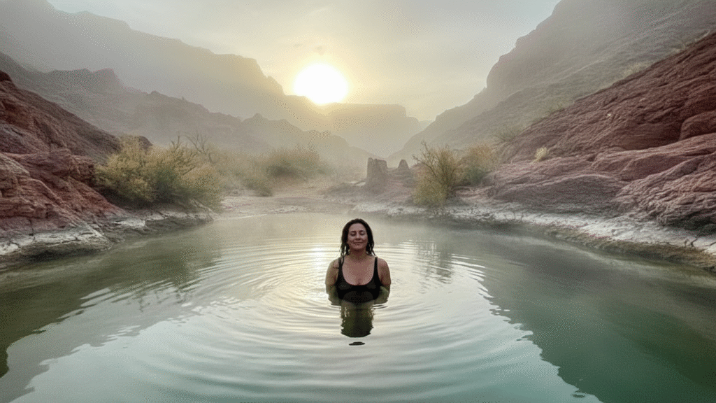
Hidden Hot Springs and Thermal Pools
Arizona’s geothermal activity creates natural hot springs in remote locations. (See your existing thermal pools guide for comprehensive coverage—here are additional lesser-known sites.)
Ringbolt Hot Springs
Colorado River hot spring accessible only by kayak or raft.
Location: River mile 230 in Grand Canyon (multi-day river trip required).
Temperature: 90-100°F flowing into river.
Access: Commercial river trips or private permit (lottery system).
Significance: One of Grand Canyon’s most famous riverside hot springs.
Sheep Bridge Hot Spring
Verde River hot spring requires paddling from Horseshoe Dam.
Access: Launch kayaks at Horseshoe Dam, paddle 15+ miles downstream.
Temperature: Warm (80s°F) rather than truly hot.
Camping: Primitive camping along river corridor.
Commitment: Full-day or overnight paddling trip required.
Fossil Creek Hot Springs
At Fossil Creek’s source, warm springs feed the creek system.
Temperature: 72°F (warm, not hot) creating perfect swimming conditions.
Access: Permits required April-October (see Fossil Creek section above).
Note: These are the springs feeding the entire Fossil Creek system.
Indian Hot Springs
Near Springerville, developed hot springs offer rustic soaking.
Facilities: Basic pools and primitive camping.
Temperature: 103°F at source, cooler in pools.
Access: Private property with day-use fees.
Crowds: Moderate—locals use frequently.
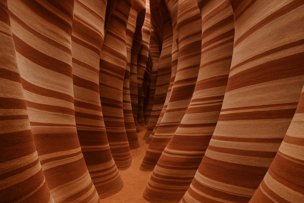
Unknown Slot Canyons and Rock Formations
Beyond Antelope Canyon’s fame, Arizona conceals hundreds of lesser-known slot canyons.
Secret Canyon (Sedona)
Despite the name, Secret Canyon requires permits but offers authentic slot experience.
Access: Forest Service permit required (free). 4WD to trailhead.
Hike: 5 miles to canyon entrance, technical scrambling through slots.
Crowds: Light due to difficult access and permit requirement.
Best time: April-May and September-October (avoid monsoons).
Keyhole Canyon
Near Page, this slot canyon sees fraction of Antelope’s traffic.
Technical rappelling required: Three rappels (20′, 35′, 30′) make this a canyoneering route.
Experience necessary: Not for beginners. Proper gear and skills essential.
Permits: Navajo Nation permit required.
Water: Can contain standing water in sections.
Crack Canyon
Marble Canyon area slot requiring 4WD and navigation.
Access: Remote dirt roads from House Rock Valley Road.
Length: Several miles of narrow canyon exploration possible.
Crowds: Virtually none—you’ll likely explore alone.
Flash flood danger: Never enter when rain threatens.
Wire Pass to Buckskin Gulch Tributaries
Unnamed side canyons branching from main Buckskin Gulch.
Access: From Wire Pass trailhead (permits required for overnight).
Exploration: Multiple unnamed slots branch off the main canyon.
Navigation: GPS and topo maps essential for side canyon exploration.
Commitment: Day hikes possible, but longer trips reveal best sections.
Alamo Canyon
Remote Kofa Mountains slot canyon requiring serious commitment.
Access: 4WD roads from Kofa refuge, then cross-country navigation.
Slot sections: Narrow passages through volcanic rock.
Crowds: Extremely rare—perhaps a dozen visitors annually.
Season: November-March only (summer heat deadly).
Off-the-Radar Ghost Towns and Historic Sites
(See your ghost towns guide for comprehensive coverage. Here are additional sites not covered there.)
Metcalf & Clifton Area Ghost Towns
Eastern Arizona mining district with multiple abandoned sites.
Metcalf: Hillside ruins overlooking Clifton. Limited access due to private property.
Clifton: Partial ghost town with some residents. Historic downtown preserves mining-era architecture.
Morenci: Active mine but historic townsite relocated. Open pit operations continue.
Access: Highway 191 through Clifton. Observe private property boundaries.
Charleston Ghost Town
Near Tombstone, Charleston served as mill town for Tombstone silver.
Ruins: Scattered foundations along San Pedro River.
Access: BLM land, free access via dirt roads from Highway 90.
Historic significance: Wyatt Earp and Doc Holliday spent time here.
Photography: Limited structures remain but setting offers atmosphere.
Fairbank Historic Townsite
San Pedro River ghost town with preserved structures.
BLM site: Free access, interpretive signs explain history.
Buildings: Several structures remain including schoolhouse and mercantile.
Trails: Short walking paths through townsite and riparian area.
Crowds: Light—mostly locals and informed travelers.
Pearce Ghost Town
Eastern Arizona mining town with interesting ruins.
Pearce Store: Historic general store now operates as museum (limited hours).
Cemetery: Old Pearce Cemetery preserves mining-era graves.
Commonwealth Mine site: Ruins of significant gold operation.
Access: Off Highway 191 between Sunsites and Cochise.
Remote Hiking and Backpacking Destinations
Superstition Wilderness Eastern Section
While western Superstitions see heavy day-hiking traffic, the eastern wilderness remains remarkably quiet.
Rogers Canyon provides multi-day backpacking access through varied terrain. The long approach keeps crowds minimal.
Reavis Ranch historic site sits in remote wilderness valley. Multiple access routes allow loop trips.
Circlestone prehistoric site requires serious navigation and commitment. The archaeological site features circular stone arrangement of unknown origin.
Campaign Creek offers solitude and seasonal water. The primitive trail demands navigation skills.
Miller Peak Wilderness
Southern Arizona’s highest peak (9,466′) anchors this 20,190-acre wilderness.
Miller Peak Trail climbs from Montezuma Pass (Coronado National Memorial) to the summit. The 5-mile climb gains 3,700 feet with outstanding views into Mexico.
Copper Canyon provides remote backpacking in the wilderness interior. The loop requires overnight commitment.
Pat Scott Peak offers alternative summit with even less traffic than Miller Peak.
Access: Montezuma Pass (paved), Forest Road 48 (high-clearance).
Rincon Mountains Wilderness
Eastern Tucson wilderness within Saguaro National Park protects 38,590 acres.
Tanque Verde Ridge Trail climbs from desert to pine forest gaining 6,000 feet over 15 miles.
Manning Camp backcountry site at 8,000 feet offers overnight destination in pine forest (permit required).
Mica Mountain (8,666′) provides the range’s high point accessed via several trails.
Italian Trap Trail offers quieter access with fewer hikers than main corridors.
Granite Mountain Wilderness
North of Prescott, this wilderness protects the distinctive Granite Mountain formation.
Granite Mountain Trail #261 climbs 4 miles to 7,626-foot summit. The trail sees moderate traffic but wilderness beyond remains quiet.
Blair Pass serves as gateway to wilderness interior. Backpacking loops into Little Granite Mountain create multi-day trips.
Rock climbing: The granite formations attract technical climbers (experience required).
Aravaipa East Wilderness
Separate from main Aravaipa Canyon, this wilderness protects the upper watershed.
Virgus Canyon Trail accesses remote wilderness from the north. The trail sees perhaps a dozen hikers annually.
Deer Creek provides backpacking access to wilderness interior. Navigation skills required beyond maintained trail sections.
Day trips or overnights: Flexibility in trip length accommodates various schedules.
Secret Scenic Drives and Overlooks
Alamo Lake Road at Sunset
Highway 93 to Alamo Lake State Park transitions through beautiful desert and grassland.
Scenic qualities: Rolling desert hills, saguaro forests, and seasonal wildflowers.
Traffic: Light—this road sees minimal traffic beyond lake visitors.
Wildlife: Excellent for pronghorn antelope viewing in open country.
Best time: Spring wildflowers (March-April) or fall golden hour.
Control Road (Apache-Sitgreaves)
Forest Road 300 traverses the Mogollon Rim for 200+ miles from Holbrook to Springerville.
Highlights: Rim views, alpine meadows, aspen groves, and complete solitude.
Access: Passenger cars in summer; high-clearance recommended. Closed in winter.
Camping: Dispersed camping throughout with incredible sites.
Length: Days required to explore fully. Multiple access points allow shorter segments.
Schnebly Hill Road (Sedona)
The first 3 miles (paved) attracts crowds, but beyond that point, high-clearance vehicles access remote backcountry.
Upper sections: Connect to Mogollon Rim with spectacular red rock views.
Traffic: Heavy initially, then drops off dramatically.
4WD recommended: Rough sections challenge vehicles.
Camping: Dispersed sites in national forest sections.
Dugas Road (Bradshaw Mountains)
Forest Road 52 from Crown King to Prescott crosses historic mining district.
Scenic qualities: Pine forest, mountain meadows, and mining ruins.
Conditions: High-clearance required, 4WD helpful. Slow going (10 mph average).
Historic sites: Multiple ghost towns and mines along the route.
Length: Allow 3-4 hours for 30-mile section.
Swift Trail (Mount Graham)
Highway 366 climbs from Sonoran desert to alpine forest in 36 miles gaining over 6,000 feet elevation.
Highlights: Dramatic ecosystem transitions, incredible views, and access to Mount Graham International Observatory.
Conditions: Paved but steep with tight turns. Closed in winter.
Stops: Multiple overlooks, campgrounds, and trailheads.
Top elevation: Over 10,000 feet at highest accessible point.
Hidden Ancient Ruins and Petroglyphs
Kinishba Ruins
White Mountain Apache Reservation site near Whiteriver with extensive pueblo remains.
Structures: 600+ rooms across multiple plazas occupied 1200s-1400s CE.
Access: Tribal permit required. Limited hours, check ahead.
Significance: One of Arizona’s largest prehistoric pueblos.
Crowds: Very light—few tourists make the journey.
V-Bar-V Heritage Site
Verde Valley petroglyph site with over 1,000 rock art elements.
Access: Short walk from parking area (fee required).
Art styles: Sinagua culture designs from 1150-1400 CE.
Crowds: Moderate but manageable with timed entry.
Photography: Morning light best for petroglyph documentation.
Hieroglyphic Canyon
Superstition Wilderness trailhead features extensive petroglyph panels.
Access: 3-mile round-trip hike from trailhead.
Art: Multiple panels with various design elements.
Crowds: Moderate on weekends, light weekdays.
Respect: Never touch rock art. Oils from skin damage ancient images.
Signal Hill (Saguaro West)
Tucson-area petroglyph site with Hohokam spiral designs.
Access: Short paved path from parking area.
Sunset: West-facing creates excellent evening lighting.
Crowds: Moderate but diffuses across site.
Significance: Solstice markers and astronomical alignments.
Picture Rocks Petroglyphs
Northwest Tucson BLM site with numerous panels.
Access: Dirt roads to various rock art locations.
Panels: Multiple sites scattered across desert landscape.
Crowds: Light—most tourists visit more accessible sites.
Exploration: Multiple panels reward hiking between sites.
Undiscovered Wildlife Viewing Areas
Buenos Aires National Wildlife Refuge
South of Tucson near Sasabe, this 118,000-acre refuge protects grassland and endangered species.
Masked bobwhite quail: Refuge manages reintroduction of endangered subspecies.
Pronghorn: Sonoran pronghorn antelope (another endangered subspecies) inhabit the refuge.
Birds: 300+ species recorded including grassland specialists.
Access: Dirt roads crisscross refuge. Visitor center provides maps.
Crowds: Minimal—this refuge sees far fewer visitors than more accessible areas.
San Bernardino National Wildlife Refuge
Extreme southeastern Arizona refuge bordering Mexico.
Yaqui fish: Refuge protects endangered native fish species.
Birds: Excellent diversity including Mexican species at northern range limits.
Ponds: Artesian springs create permanent water supporting wildlife.
Access: Remote location keeps visitation low.
Border: Be aware this is border area. Follow all law enforcement instructions.
Cibola National Wildlife Refuge
Colorado River refuge south of Blythe protecting riparian habitat.
Waterfowl: Winter concentrations of ducks and geese.
Hiking: Trails through mesquite bosque and wetlands.
Camping: Primitive camping permitted in designated areas.
Location: Colorado River creates green corridor through desert.
Bill Williams River National Wildlife Refuge
Where Bill Williams River joins the Colorado River.
Canoeing: Paddle the river through refuge (seasonal water levels).
Wildlife: Excellent bird diversity, beaver activity visible.
Trails: Limited hiking access through riparian forest.
Crowds: Very light despite proximity to Highway 95.
Ramsey Canyon Preserve
Nature Conservancy site in Huachuca Mountains.
Hummingbirds: 15+ species recorded, best April-September.
Trails: Several short trails through canyon.
Access: Reservations required for day-use (limited visitors).
Overnight: Nature Conservancy maintains small inn (reservations essential).
Lesser-Known Camping and Stargazing Spots
Sunflower Dispersed Camping Area
North of Phoenix, Forest Road 27 offers excellent dispersed camping.
Access: High-clearance recommended for best sites.
Elevation: 4,000-5,000 feet provides cooler summer temperatures.
Facilities: None. Practice Leave No Trace principles.
Stargazing: Excellent dark skies despite relative proximity to Phoenix.
Perkinsville Road Dispersed Sites
Between Jerome and Williams, numerous forest roads lead to camping.
Scenery: Sycamore Canyon rim country with ponderosa forest.
Access: High-clearance vehicles required for many spots.
Privacy: Sufficient space to find solitary sites.
Activities: Hiking, mountain biking, and exploring nearby.
Rose Peak/Hannagan Meadow Area
White Mountains dispersed camping at high elevation.
Elevation: 9,000+ feet in some areas.
Summer: Cool temperatures, wildflower meadows.
Access: Forest roads from Highway 191 (some require high-clearance).
Wildlife: Elk frequent area, especially evening and morning.
Kofa NWR Dispersed Camping
Throughout the refuge, dispersed camping allowed in designated zones.
Solitude: Supreme isolation in desert wilderness.
Stargazing: Dark sky designation quality skies.
Season: November-March only (summer deadly).
Access: High-clearance required for most sites.
Mogollon Rim Dispersed Camping
Countless sites along Forest Road 300 and spur roads.
Variety: From developed fee sites to primitive dispersed camping.
Views: Many sites overlook rim edge with expansive vistas.
Access: Varies by location—some accessible to passenger cars, others requiring high-clearance.
Best season: May-October (winter snow closes roads).
Part IV: Advanced Planning
Creating Your Off the Beaten Path Itinerary
Match destinations to capabilities honestly. Remote Arizona demands skills, equipment, and physical condition. Don’t attempt advanced destinations without proper preparation.
Start with accessible hidden gems. Build skills and confidence before tackling truly remote sites. Successful trips to moderate locations prepare you for challenging ones.
Group similar destinations geographically. Arizona’s size makes efficient routing essential. Cluster nearby hidden gems into multi-day regional trips.
Research current conditions. Call ranger districts, check recent trip reports, and verify road conditions before departing. Conditions change rapidly—don’t rely on outdated information.
Build in flexibility. Weather, road conditions, or unexpected discoveries might alter plans. Avoid rigid schedules that don’t accommodate changes.
Leave detailed itineraries. Someone should know your route, destinations, and expected return. If you don’t return on schedule, they should contact authorities.
Sample itinerary framework:
Day 1: Accessible hidden gem (test equipment and preparation)
Day 2: Moderate challenge destination (build confidence)
Day 3: More remote location (apply skills from previous days)
Day 4: Rest day or alternative based on conditions
Day 5: Challenging destination (if conditions and skills align)
Day 6: Buffer day (accommodate delays or extended exploration)
Day 7: Return via scenic route with stops at additional hidden gems
Resources and Tools for Finding Hidden Gems
Digital resources:
Gaia GPS provides topographic maps, satellite imagery, and offline functionality essential for remote navigation.
OnX Offroad/Backcountry shows land ownership, boundaries, and access routes. Understanding public vs. private land prevents trespassing.
FreeRoam helps locate dispersed camping sites on public lands with user-generated reviews and GPS coordinates.
Recreation.gov handles permits for federal sites. Book early for popular hidden gems requiring reservations.
Arizona State Parks website provides information on lesser-known state parks and natural areas.
Avenza Maps allows downloading georeferenced PDF maps for offline use. Many land management agencies provide maps in this format.
Print resources:
Arizona Atlas & Gazetteer (DeLorme) shows backroads, trails, and topography across the entire state. Essential for route planning.
Arizona Highways magazine frequently features lesser-known destinations with practical information.
Hiking Arizona and similar guidebooks provide trail descriptions including difficulty ratings and access directions.
Forest Service and BLM maps show roads, trails, and facilities in specific areas. Available at ranger stations and online.
Local knowledge:
Ranger stations staff can provide current conditions, recommendations, and safety information. Visit in person when possible.
Local outdoor shops often know hidden gems and current access situations. Staff can recommend destinations matching your interests and capabilities.
Arizona hiking and exploring clubs organize trips to remote destinations with experienced leaders. Joining group trips builds skills.
Online forums (Arizona-specific hiking and exploring communities) share trip reports and current conditions. Contribute your knowledge to maintain community.
Seasonal Considerations
Spring (March-May)
- Best regions: Southern and central Arizona low country
- Advantages: Wildflowers, comfortable temperatures, water sources flowing
- Disadvantages: Spring break crowds at accessible sites, limited high-elevation access
- Top destinations: Organ Pipe backcountry, Aravaipa Canyon, Superstition Wilderness
Summer (June-August)
- Best regions: White Mountains, Mogollon Rim, North Rim areas
- Advantages: High-elevation access opens, cool forest temperatures, wildflower meadows
- Disadvantages: Desert destinations dangerous, monsoon flash floods
- Top destinations: Blue Range, Mount Baldy Wilderness, Kaibab Plateau backcountry
Fall (September-November)
- Best regions: Transition zones work across elevations
- Advantages: Comfortable temperatures statewide, aspens changing, reduced crowds
- Disadvantages: Hunting season (check dates/areas), early snow possible at high elevations
- Top destinations: Mazatzal Wilderness, Sierra Ancha, Mogollon Rim country
Winter (December-February)
- Best regions: Low desert, southern Arizona
- Advantages: Perfect desert temperatures, solitude, dark skies
- Disadvantages: High elevations snowed in, some water sources frozen, short daylight
- Top destinations: Kofa NWR, Cabeza Prieta, Eagletail Mountains
Frequently Asked Questions FAQs
Q: How do I find hidden destinations without GPS coordinates?
A: Study topographic maps, read detailed descriptions, and develop map-reading skills. Part of “hidden gem” appeal comes from discovery through research and exploration rather than following exact waypoints. Learning navigation skills enhances experiences beyond simply following tracks.
Q: Are off-the-beaten-path destinations safe for solo travel?
A: Many experienced adventurers safely explore solo with proper preparation. However, remote Arizona creates risks—vehicle breakdowns, injuries, or getting lost become serious when alone. If traveling solo, use satellite communication, inform others of plans, and choose destinations matching your experience level. Partner or group travel adds safety margin.
Q: Can I visit these places in an RV or trailer?
A: Most hidden gems require leaving RVs/trailers at established campgrounds and accessing sites via day trips. Dirt road limitations, low clearances, and tight turns prevent large vehicle access. Plan to use smaller vehicles for exploring while maintaining base camp.
Q: How do I know if I need permits?
A: Research each destination through managing agency websites. National parks, wilderness areas, and some BLM lands require permits. When uncertain, contact the managing agency directly. Never assume access without verification—trespassing and permit violations carry substantial penalties.
Q: What if I encounter other people at a "hidden" destination?
A: No guarantee exists for absolute solitude anywhere accessible. Be gracious, practice good trail etiquette, and recognize others have equal rights to public lands. If crowds concern you, visit weekdays, choose more remote alternatives, or embrace shared appreciation of special places.
Q: How do I balance sharing discoveries with protecting them?
A: Consider each location’s fragility. Developed sites with infrastructure can handle publicity. Extremely fragile or threatened sites benefit from discretion. When sharing, emphasize Leave No Trace ethics, respect for regulations, and responsible visitation. Avoid exact coordinates for the most vulnerable locations.
Q: What vehicle do I actually need?
A: Requirements vary dramatically. Many excellent hidden gems require only passenger cars on maintained dirt roads. Others demand serious 4WD capability with high clearance. Research specific destinations thoroughly. Don’t risk your vehicle beyond its capabilities—turning back isn’t failure, it’s wisdom.
Q: Can I bring my children to hidden destinations?
A: Age-appropriate destinations absolutely exist. Shorter hikes to swimming holes, accessible ghost towns, and developed camping areas work well for families. Avoid remote locations with hazards (mine shafts, extreme heat, difficult navigation) until children are older. Build family skills progressively.
Q: What if I find undiscovered ruins or artifacts?
A: Federal law protects all archaeological resources on public land. If you discover unknown ruins, document location with photos and GPS coordinates, then report to the managing agency. Never disturb, excavate, or remove artifacts. Professional archaeologists can properly study significant discoveries.
Q: How do I deal with cell phone coverage gaps?
A: Expect zero coverage in remote areas. Download offline maps before leaving coverage. Carry physical maps as backup. Consider satellite communicators for emergencies. Brief others on your route so they know where to search if you don’t return on schedule.
Protecting Arizona's Hidden Treasures

Off-the-beaten-path Arizona offers experiences impossible to find at famous destinations: authentic solitude, personal discovery, and connections with wild places on their own terms rather than through interpretive signs and designated viewpoints.
These hidden gems survive because people like you choose to explore responsibly. Every visitor who follows Leave No Trace principles, respects regulations, and treats fragile places with care helps ensure these destinations remain accessible to future generations.
Conversely, careless behavior—littering, vandalism, trespassing, or social media exploitation—rapidly destroys what took centuries to create. The choice belongs to each visitor: protect these places through respectful exploration, or contribute to their degradation through thoughtlessness.
Your responsibilities as an off-the-beaten-path explorer:
Research thoroughly before visiting to understand regulations, access, and appropriate skills required
Travel prepared with necessary equipment, supplies, and contingency plans for emergencies
Leave no trace of your presence beyond temporary footprints that rain and wind erase
Respect closures and regulations even when you disagree with them
Share wisely to inspire others while protecting the most fragile locations
Support conservation through memberships, donations, and advocacy for public lands
Build skills progressively to safely access more remote destinations
Give back through volunteer projects maintaining trails and protecting sites
Arizona’s hidden gems span incredible diversity—from slot canyons to hot springs, ghost towns to wilderness peaks, secret swimming holes to ancient ruins. This guide provides starting points, but true discovery happens through your personal exploration, learning, and connection with these remarkable places.
The best hidden gem might be one you discover yourself through map study, local conversation, or curious exploration down an unnamed forest road. Those personal discoveries create the strongest memories and deepest appreciation for Arizona’s wild character.
Get out there. Explore responsibly. Protect what you find. And experience the Arizona that exists beyond Instagram hotspots and tour buses—the authentic, wild, challenging, beautiful hidden corners where true adventure still awaits.
The desert, mountains, and canyonlands are waiting. Pack your maps, check your vehicle, grab your water bottles, and discover the Arizona most travelers never see.
Find Your Perfect Arizona Getaway
Ready to explore more of Arizona? Browse destination guides, unique stays, hidden gems, and outdoor adventures to build your ideal weekend escape.
Start Planning Your Next Adventure Weekend Getaway in Arizona
Related Arizona Travel Guides:
- 7 Secret Slot Canyons Near Page Arizona (That Aren’t Antelope Canyon)
- Arizona Hot Springs Hiking Guide
- 5 Day Northern Arizona Road Trip
This post may contain affiliate links for accommodations and tours. We earn a small commission at no extra cost to you, helping us create more free Arizona travel content. All budget calculations and recommendations are based on our genuine experiences.
Check Us out On Pinterest
Table of Contents
Toggle