5 Day Northern Arizona Road Trip Itinerary Through Hidden Gems
Northern Arizona Road Trip Intinerary Intro
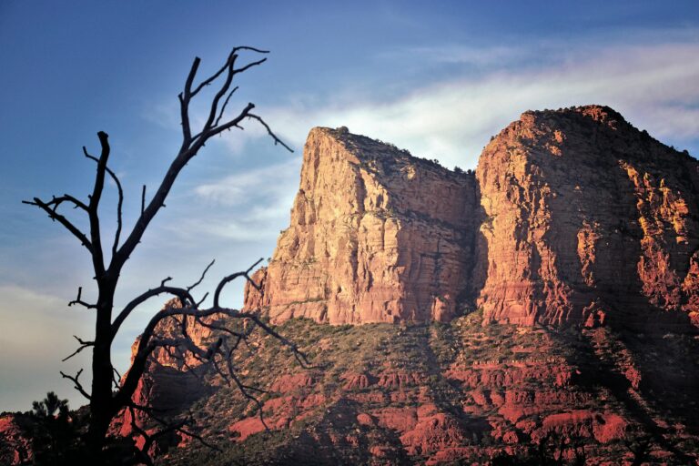
Northern Arizona delivers some of the Southwest’s most dramatic landscapes packed into a compact region—red rock formations, alpine forests, ancient slot canyons, and the incomparable Grand Canyon all sit within a day’s drive of Phoenix. This density of natural wonders makes Northern Arizona the perfect road trip destination, offering the freedom to explore at your own pace while experiencing incredible diversity.
After years of exploring Northern Arizona’s highways and backroads, testing different routes and timing strategies, and discovering both famous landmarks and hidden treasures, we’ve refined this journey into a comprehensive 5-day itinerary that balances iconic destinations with off-the-beaten-path discoveries. This isn’t a rushed sprint hitting only the major attractions—it’s a thoughtfully paced adventure that allows time to truly experience each destination while building in flexibility for spontaneous detours.
In this complete Northern Arizona road trip guide, we’re sharing our day-by-day itinerary covering Sedona’s red rocks, Flagstaff’s mountain charm, the Grand Canyon’s majesty, and Page’s spectacular slot canyons and water recreation. Whether you’re seeking outdoor adventure, photography opportunities, cultural experiences, or simply escape from the Valley’s summer heat, this route delivers unforgettable experiences that showcase why Northern Arizona captivates millions of visitors annually.
In This Guide
- Why Northern Arizona for a Road Trip?
- Route Overview & Key Distances
- Day 1: Phoenix to Sedona
- Day 2: Sedona Exploration & Drive to Flagstaff
- Day 3: Flagstaff & Grand Canyon Day Trip
- Day 4: Flagstaff to Page
- Day 5: Page Exploration & Return to Phoenix
- Alternative Routes & Extensions
- Total Trip Budget Breakdown
- Best Time for Northern Arizona Road Trips
- Essential Packing List
- Road Trip Safety & Tips
- Frequently Asked Questions
Why Northern Arizona for a Road Trip?
Northern Arizona offers unmatched diversity within a compact geographic area, making it ideal for multi-day road trips that don’t require endless driving between destinations.
Landscape Diversity:
Experience dramatic elevation changes from Phoenix (1,100 feet) through Sedona (4,500 feet) and Flagstaff (7,000 feet) to Page (4,300 feet). Each elevation brings distinct ecosystems—from saguaro-dotted Sonoran Desert to ponderosa pine forests to high desert canyonlands—all within hours of each other.
Manageable Distances:
Total driving time across the entire 5-day itinerary is approximately 12-14 hours spread across multiple days. No single day requires more than 3.5 hours of driving, leaving ample time for exploration, dining, and spontaneous stops.
Four-Season Accessibility:
Unlike many mountain destinations that close during winter, Northern Arizona’s main routes remain accessible year-round. While seasonal considerations exist (summer heat, winter snow), we can always find spectacular experiences regardless of travel dates.
Cultural and Geological Richness:
Beyond natural beauty, Northern Arizona offers rich Native American heritage, Old West history, astronomy centers, art galleries, and geological features that tell stories spanning millions of years.
Photography Paradise:
From sunrise over Horseshoe Bend to golden hour in Oak Creek Canyon, Northern Arizona delivers world-class photography opportunities during every season and at every destination.
Route Overview & Key Distances
The Complete Loop: Phoenix → Sedona → Flagstaff → Page → Phoenix
Total Distance: Approximately 750 miles
Total Driving Time: 12-14 hours (spread across 5 days)
Elevation Range: 1,100 feet (Phoenix) to 7,000 feet (Flagstaff)
Day-by-Day Distance Breakdown
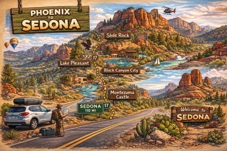
Day 1: Phoenix to Sedona
- Distance: 115 miles
- Driving Time: 2 hours
- Route: I-17 North to Highway 179
Day 2: Sedona to Flagstaff
- Distance: 30 miles
- Driving Time: 45 minutes
- Route: Highway 89A through Oak Creek Canyon
Day 3: Flagstaff Base (Grand Canyon Day Trip)
- Distance: 160 miles roundtrip
- Driving Time: 3 hours roundtrip
- Route: I-40 West to Highway 64 North
Day 4: Flagstaff to Page
- Distance: 135 miles
- Driving Time: 2.5 hours
- Route: Highway 89 North
Day 5: Page to Phoenix
- Distance: 280 miles
- Driving Time: 4.5 hours
- Route: Highway 89 South to I-17 South
Alternative: Return via Highway 89A through Prescott adds 30-45 minutes but offers scenic variety
Alternative Shorter Itineraries
3-Day Condensed Version:
Day 1: Phoenix → Sedona (overnight)
Day 2: Sedona → Flagstaff (overnight)
Day 3: Flagstaff → Phoenix (via Prescott or direct)
7-Day Extended Version:
Add extra nights in Sedona (2 nights total) and Page (2 nights total) for deeper exploration including:
- Additional Sedona hiking (Devil’s Bridge, Cathedral Rock, West Fork)
- Antelope Canyon guided tour
- Lake Powell recreation
- Monument Valley day trip from Page
Day 1: Phoenix to Sedona
Morning: Departure from Phoenix (Aim for 7-8 AM Start)
Start your Northern Arizona road trip early to maximize daylight in Sedona and avoid midday heat during the drive. The route follows I-17 North, a straightforward Interstate highway that climbs steadily from Phoenix’s desert basin into higher elevations.
The Drive: 115 miles, approximately 2 hours
From Phoenix, take Interstate 17 northbound toward Flagstaff. Around mile marker 298, exit onto Highway 179 (Exit 298) toward Sedona. This exit puts you on the scenic approach into Sedona from the south, offering your first glimpses of red rock formations.
Notable Stops En Route:
Sunset Point Rest Area (Mile 252):
Clean facilities, vending machines, and scenic views overlooking the high desert. Perfect quick break approximately 45 minutes from Phoenix.
Black Canyon City:
Last convenient gas and food stop before Sedona (though gas exists in Camp Verde). Fill up here if running low.
Montezuma Castle National Monument (Optional 30-minute detour):
A 5-story, 20-room cliff dwelling built by ancestral Puebloan people. Located just off I-17 at Exit 289. Entry fee $10 per person or free with America the Beautiful Pass. We recommend saving this for another trip to avoid losing Sedona daylight, but it’s an excellent addition if traveling with history enthusiasts.
Late Morning/Midday: Arrival in Sedona (10-11 AM)
First Stop: Chapel of the Holy Cross
GPS: 780 Chapel Road, Sedona, AZ 86336
Begin your Sedona experience at this architectural marvel built directly into red rock formations. The modernist chapel offers stunning views across the valley and provides excellent orientation to Sedona’s layout.
- Parking: Small lot fills quickly (arrive before 11 AM or after 3 PM)
- Cost: Free
- Time Needed: 30-45 minutes
- Accessibility: Short walk up paved path to chapel
Pro Tip: The chapel parking lot offers one of Sedona’s best free viewpoints even if you don’t enter the building.
Midday: Lunch & Downtown Exploration
Lunch Options:
Indian Gardens Cafe & Market (Uptown Sedona):
Healthy Southwestern-inspired cuisine with indoor/outdoor seating. Try the rainbow veggie sandwich or Sedona burger. Budget: $12-18 per person.
Wildflower Bread Company:
Excellent sandwiches, salads, and baked goods. Great for quick lunch. Budget: $10-15 per person.
Oak Creek Brewery & Grill (Tlaquepaque Arts & Shopping Village):
Craft beer, burgers, and riverside patio dining. Budget: $15-20 per person.
After lunch, explore Tlaquepaque Arts & Shopping Village—a beautifully designed complex featuring galleries, boutiques, and sculptures in a Spanish colonial setting. Free to browse, beautiful for photos, and offers excellent shopping for artwork and Southwestern crafts.
Afternoon: Red Rock Scenic Byway & Bell Rock
2-3 PM: Red Rock Scenic Byway Drive
Drive the Red Rock Scenic Byway (Highway 179), one of America’s most beautiful roads. The route connects Sedona with the Village of Oak Creek, passing iconic formations including Cathedral Rock, Bell Rock, and Courthouse Butte.
Must-Stop Pullouts:
- Cathedral Rock Vista (southern view)
- Bell Rock Pathway parking area
- Courthouse Butte overlook
Bell Rock Hiking (Late Afternoon):
GPS: Bell Rock Pathway Trailhead, Highway 179 near mile marker 309
Bell Rock offers Sedona’s most accessible red rock hiking experience—a relatively flat 1-mile pathway circling the formation with options to scramble partway up the rock itself.
- Difficulty: Easy to moderate (pathway is easy, scrambling is moderate)
- Distance: 1-3.5 miles depending on route
- Elevation Gain: Minimal on pathway, 200-400 feet if scrambling
- Time Needed: 1-2 hours
- Cost: $5 Red Rock Pass per vehicle per day (or $15 weekly pass)
- Best Timing: Late afternoon light (3-5 PM) creates beautiful photography conditions
Pro Tips:
PRO TIP: Purchase the Red Rock Pass ($15 weekly) rather than daily passes if you’ll be hiking multiple days in Sedona. It’s valid at all Coconino National Forest trailheads and pays for itself after three days.
Bell Rock can be extremely crowded at sunset. If you want solitude, hike in late afternoon (3-4 PM) and wrap up before the sunset crowd arrives.
Evening: Sunset & Dinner
Sunset Location: Airport Mesa Vortex
GPS: 1185 Airport Road, Sedona
Airport Mesa offers 360-degree sunset views over Sedona with relatively easy access via a short trail from the parking area.
- Distance from parking: 0.5 miles one-way
- Elevation gain: Approximately 200 feet
- Time needed: 1 hour total (including sunset viewing)
- Crowds: Very popular—arrive 45 minutes before sunset for parking
Dinner Recommendations:
Elote Cafe (Budget-Splurge):
Exceptional Mexican-influenced cuisine using local ingredients. Reservations essential. Budget: $25-35 per person.
Creekside American Bistro:
Upscale dining with creek views. Try the salmon or ribeye. Budget: $30-40 per person.
Budget Option – Chipotle or local tacos:
Multiple affordable options in Sedona shopping centers. Budget: $8-12 per person.
Where to Stay: Night 1
Budget Options:
- Sky Ranch Lodge: $110-140/night, great views, pool
- Sedona Motel: $90-120/night, basic but clean, walkable location
- Best Western Plus Inn of Sedona: $130-160/night, reliable chain
Mid-Range:
- Arabella Hotel Sedona: $150-200/night, boutique property, excellent location
- Southwest Inn at Sedona: $140-180/night, comfortable rooms, good value
Camping:
- Manzanita Campground (Oak Creek Canyon): $26/night, first-come first-served, stunning location
- Cave Springs Campground: $26/night, reservable via Recreation.gov
Money-Saving Alternative:
Stay in Village of Oak Creek (6 miles south) or Cottonwood (20 miles away) for 30-40% lower rates. Budget chains in these areas: $80-110/night.
Day 2: Sedona Exploration & Drive to Flagstaff
Morning: Oak Creek Canyon & Slide Rock
7-8 AM: Early Start for Oak Creek Canyon
Highway 89A through Oak Creek Canyon is considered one of the most scenic drives in America. This 16-mile route from Sedona to Flagstaff follows Oak Creek through a dramatic forested canyon with towering cliffs, abundant vegetation, and numerous pullouts offering creek access.
Driving Notes:
- The road is winding with switchbacks—allow 45-60 minutes though distance is only 16 miles
- Dozens of pullouts offer photo opportunities and creek access
- No cell service in many sections
- RVs over 40 feet not recommended
Slide Rock State Park
GPS: 6871 N Highway 89A, Sedona
Located halfway through Oak Creek Canyon, Slide Rock features natural water slides formed by slippery creek bottom rocks where Oak Creek has smoothed and polished the stone.
- Entry Fee: $10-20 per vehicle (varies by season and day)
- Best Time: Morning (7-9 AM) before crowds and heat
- Peak Season: May-September (extremely crowded)
- Activities: Swimming, sliding, hiking, picnicking
PRO TIP: Slide Rock’s water temperature rarely exceeds 60-65°F even in summer—bring water shoes and embrace the refreshing cold. The smooth creek rocks are genuinely slippery; many visitors fall. Expect to get wet even if not intentionally swimming.
Parking fills by 10 AM on summer weekends. Midweek or off-season visits offer much better experiences. If the lot is full, continue to other Oak Creek access points—multiple pullouts offer swimming without the crowds or entry fee.
Late Morning: West Fork Trail Hiking
West Fork Oak Creek Trail
GPS: Call of the Canyon Trailhead, Forest Road 89A (mile marker 384)
West Fork is considered one of Arizona’s most beautiful trails, following a year-round creek through a narrow canyon with towering walls, abundant vegetation, and frequent stream crossings.
- Distance: 6.4 miles roundtrip (3.2 miles each way)
- Difficulty: Easy to moderate
- Elevation Gain: Minimal (approximately 200 feet)
- Time Needed: 2.5-4 hours
- Cost: Red Rock Pass ($5 day/$15 week) required for parking
- Best Season: Fall (September-November) for changing leaves; spring for wildflowers
Trail Details: The maintained trail ends after 3.2 miles, but adventurous hikers can continue into the canyon indefinitely. We recommend the first 2 miles for most visitors—this section offers the most dramatic scenery with reasonable effort.
Expect to make 10-15 stream crossings depending on how far you hike. Waterproof boots or water-friendly hiking shoes are essential. Creek depth is typically ankle to calf-deep but can be deeper after rain or during spring runoff.
PRO TIP: West Fork is magnificent but gets extremely crowded, especially on weekends during fall colors season. Start by 8 AM for parking and trail solitude. Alternatively, visit on weekday mornings. The trailhead parking lot holds approximately 75 vehicles—when full, you must wait for someone to leave or return later.
Midday: Scenic Drive to Flagstaff & Lunch
12-1 PM: Complete Oak Creek Canyon Drive
Continue north on Highway 89A, completing your journey through Oak Creek Canyon. The route climbs from Sedona’s 4,500-foot elevation to Flagstaff’s 7,000 feet, with dramatic views opening up as you reach the canyon rim.
Notable Stops:
- Oak Creek Vista: Large pullout with restrooms and vendors selling Native American crafts. Stunning views back into the canyon.
- Schneebly Hill Vista (if taking alternate route): Dirt road with spectacular views. High-clearance recommended; avoid when wet.
Arrival in Flagstaff (1-2 PM):
Flagstaff sits at 7,000 feet elevation, offering pine forests and significantly cooler temperatures than Phoenix or Sedona. The historic downtown centers around Route 66, with Northern Arizona University campus adding youthful energy.
Lunch in Downtown Flagstaff:
Macy’s European Coffee House:
Flagstaff institution serving vegetarian-friendly lunch options, excellent coffee, and baked goods. Budget: $8-14 per person.
Diablo Burger:
Locally-sourced beef burgers with creative toppings. Try the Cheech (roasted jalapeño) or Vitamin B (bleu cheese and bacon). Budget: $14-20 per person.
Pizzicletta:
Authentic wood-fired Neapolitan pizza. Cozy space, often has a wait but worth it. Budget: $12-18 per person.
Afternoon: Downtown Flagstaff Exploration
2-5 PM: Walking Tour of Historic Downtown
Flagstaff’s compact downtown is highly walkable with free parking in several lots (2-hour limits on street parking, watch for signs).
Must-See Attractions:
Lowell Observatory (Optional, Extra Cost):
GPS: 1400 W Mars Hill Road
Where Pluto was discovered in 1930. Offers daytime exhibits and evening stargazing programs (weather permitting).
- Admission: $18 adults, discounts for seniors/students/children
- Hours: Vary by season, typically 10 AM-10 PM in summer, shorter winter hours
- Time Needed: 1.5-2 hours for daytime visit
Historic Route 66:
Walk the historic Route 66 corridor through downtown. Many vintage signs, classic diners, and nostalgic storefronts remain. Free and excellent for photography.
Flagstaff Visitor Center:
Located in the historic train depot. Free admission, great exhibits on local history, helpful staff can provide current recommendations.
Heritage Square:
Open-air plaza hosting farmers markets (Sundays), concerts, and festivals. Good people-watching spot with café seating.
Shopping & Galleries:
- Babbitt’s Outfitters: Historic general store, now outdoor gear retailer
- Flagstaff Art Galleries: Multiple galleries featuring local and regional artists
- Vintage shops: Several antique and vintage stores along Route 66
Evening: Dinner & Sunset
Sunset Option: Buffalo Park
GPS: 2400 N Gemini Drive
Local favorite offering short trails, mountain views, and elk sightings (especially morning and evening). Easy walking trails make this accessible for all fitness levels.
Dinner Recommendations:
Criollo Latin Kitchen:
Contemporary Latin-fusion cuisine. Try the mole dishes or ceviche. Budget: $20-30 per person.
Brix Restaurant & Wine Bar:
Upscale American cuisine with excellent wine selection. Budget: $25-35 per person.
Budget Options:
- Karma Sushi: Lunch specials and happy hour deals. Budget: $12-18 per person
- Tourist Home All Day Cafe: Breakfast and lunch served all day. Budget: $10-16 per person
Where to Stay: Night 2
Budget Options:
- Days Inn Flagstaff: $90-110/night, I-40 location
- Motel 6 East: $80-100/night, basic but clean
- University Inn: $85-105/night, near NAU campus
Mid-Range:
- Drury Inn & Suites: $130-160/night, includes breakfast and evening snacks
- Little America Hotel: $140-180/night, forested setting, large rooms
- DoubleTree by Hilton: $150-190/night, downtown location
Boutique/Historic:
- Hotel Monte Vista: $100-150/night, historic downtown hotel with character
- Starlight Pines Bed & Breakfast: $140-200/night, cozy B&B setting
Camping:
- Fort Tuthill County Campground: $30/night, close to town with hookups available
- Bonito Campground (Sunset Crater area): $26/night, beautiful forest setting
Day 3: Flagstaff & Grand Canyon Day Trip
Morning: Early Departure for Grand Canyon
6:30-7 AM: Depart Flagstaff
The Grand Canyon South Rim sits approximately 80 miles north of Flagstaff, about 1.5 hours’ drive. Early departure allows you to arrive for sunrise or shortly after, beating the crowds and experiencing the canyon in morning light.
The Drive: 80 miles, 1.5 hours
From Flagstaff, take I-40 West toward Williams for about 30 miles, then turn right onto Highway 64 North. Follow Highway 64 approximately 50 miles directly to the South Rim entrance station.
Route Notes:
- Gas available in Williams (last convenient stop) and Tusayan (1 mile before Grand Canyon)
- Minimal services between Williams and Grand Canyon
- Road is well-maintained year-round
- Clear signage to South Rim entrance
Grand Canyon National Park Entry:
- Cost: $35 per vehicle (valid 7 days) OR free with America the Beautiful Pass ($80 annual)
- Alternative: National Park passes sold at entrance station or purchase America the Beautiful Pass online in advance
PRO TIP: If you plan to visit 3+ national parks/monuments in the next year, purchase the America the Beautiful Pass ($80 annual) instead of paying individual entry fees. The pass covers entrance to all National Parks and many other federal recreation areas. It pays for itself after visiting 3 parks that charge vehicle entry fees.
Morning: South Rim Exploration (8 AM-12 PM)
First Stop: Mather Point & Visitor Center
Most visitors start at Mather Point, located near the visitor center. This easily accessible viewpoint offers dramatic first impressions of the canyon’s immensity.
- Parking: Large lot adjacent to visitor center
- Facilities: Bathrooms, visitor center, bookstore, ranger information
- Accessibility: Paved, wheelchair-accessible trails to multiple viewpoints
- Crowds: Busy but manageable if arriving before 10 AM
What to Do at Visitor Center:
- Pick up park map and ranger recommendations
- Check trail status and current conditions
- Watch orientation film (20 minutes, highly recommended)
- Stamp National Park Passport if you collect stamps
Rim Trail Walk:
The Rim Trail extends along the South Rim for 13 miles, mostly paved and relatively flat. We recommend walking westward from Mather Point toward Yavapai Point and Geology Museum as a perfect introduction.
- Distance: 1-2 miles one way (or as far as desired)
- Difficulty: Easy, mostly flat and paved
- Views: Constantly changing perspectives of the canyon
- Time Needed: 30 minutes to several hours depending on distance
Yavapai Geology Museum:
Excellent exhibits explaining how the Grand Canyon formed. Large windows offer stunning canyon views while learning about geological history. Free admission.
Mid-Morning: Choose Your Adventure (Inner Canyon OR More Rim Exploration)
OPTION A: Inner Canyon Hiking (Recommended for Fit Hikers)
90% of Grand Canyon visitors never hike below the rim—experiencing the canyon from inside provides completely different perspectives on its scale and geology.
South Kaibab Trail to Ooh Aah Point:
- Distance: 1.8 miles roundtrip
- Elevation Change: 760 feet descent (same ascending)
- Difficulty: Moderate to strenuous
- Time Needed: 1.5-2 hours
- Trail Access: Requires Kaibab Rim (Orange) shuttle bus from visitor center
This short inner canyon hike delivers spectacular views with manageable effort for most fit hikers. Ooh Aah Point offers 360-degree canyon views and a genuine sense of descending into the earth.
Important Warnings:
- Going down is easy; coming back up is much harder—save energy for ascent
- Bring minimum 1 liter water per person
- Start early before midday heat
- Never attempt to reach Colorado River and return same day (fatal error many make)
Alternative Inner Canyon Option – Bright Angel Trail:
Bright Angel Trail features tunnel sections and rest houses with water. Popular turnaround points include 1.5-Mile Resthouse (3 miles roundtrip) or 3-Mile Resthouse (6 miles roundtrip). This trail is more gradual than South Kaibab but longer for equivalent views.
OPTION B: Rim Viewpoints Tour (Relaxed Pace)
Use the free park shuttle system to visit multiple rim viewpoints without hiking below the rim. This option works well for those with limited mobility, young children, or who prefer more relaxed exploration.
Red Route (Hermit Road, westbound):
Operates March-November only (private vehicles allowed December-February)
- Hopi Point: Spectacular 180-degree views, excellent for sunrise/sunset
- Mohave Point: Views of Colorado River
- The Abyss: Sheer 3,000-foot drop
- Hermits Rest: Historic Mary Colter building, turnaround point
Blue Route (Village Route):
Year-round operation connecting main facilities
- Bright Angel Lodge: Historic lodge with canyon views
- El Tovar Hotel: Grand Canyon’s premier historic hotel
- Verkamp’s Visitor Center: Historic building with Grand Canyon Association bookstore
Midday: Lunch & Continued Exploration (12 PM-3 PM)
Lunch Options:
Bring Picnic:
Multiple picnic areas exist throughout the park. This is our recommended option—pack sandwiches and snacks from Flagstaff grocery stores for significant savings and flexibility.
Grand Canyon Village Dining:
- Bright Angel Restaurant: Table service, $12-20 per person
- Maswik Food Court: Quick service, pizza/burgers/salads, $10-15 per person
- El Tovar Dining Room: Upscale, reservations required, $25-40 per person
- General Store Deli: Grab-and-go sandwiches, $8-12 per person
Afternoon Activity Options:
Desert View Drive (East Rim):
The eastern section offers a 22-mile scenic drive with multiple viewpoints and fewer crowds than the main village area.
Key Stops:
- Grandview Point: Historic viewpoint, impressive canyon vistas
- Moran Point: Excellent photography spot
- Tusayan Pueblo: Small ancestral Puebloan ruin (800 years old)
- Lipan Point: Views of Colorado River
- Desert View Watchtower: Mary Colter’s masterpiece, climb for panoramic views ($5 suggested donation)
This drive requires 2-3 hours minimum including stops. If you have time, it provides excellent contrast to the busy main village area and offers the option to exit via the East entrance on your return to Flagstaff.
Alternative Afternoon Activities:
- Ranger Programs: Free talks and walks offered throughout the day (check schedule at visitor center)
- Trail of Time: Outdoor geology exhibit along Rim Trail
- Historic Building Tours: Self-guided or ranger-led tours of El Tovar, Bright Angel Lodge, Hopi House
Late Afternoon: Return to Flagstaff (3-4 PM Departure)
Return Drive: 1.5 hours
If you explored Desert View Drive, you can exit via the East entrance and return to Flagstaff via Highway 64 to Highway 89. This alternate route adds approximately 15 minutes but offers scenery variety.
Standard return route: Retrace Highway 64 South to Williams, then I-40 East to Flagstaff.
Evening: Flagstaff Dinner & Rest
After a full Grand Canyon day, enjoy a relaxed evening in Flagstaff. Consider:
- Early dinner: 5-6 PM to accommodate tired bodies
- Simple meal: Pizza, burgers, or casual dining
- Early bedtime: Tomorrow brings the longest driving day
Dinner Suggestions:
- Pizzicletta: Wood-fired pizza, cozy atmosphere
- Fratelli Pizza: Casual Italian, good beer selection
- Galaxy Diner: Classic American diner, comfort food
Stay in same accommodation as Night 2 to avoid packing/unpacking.
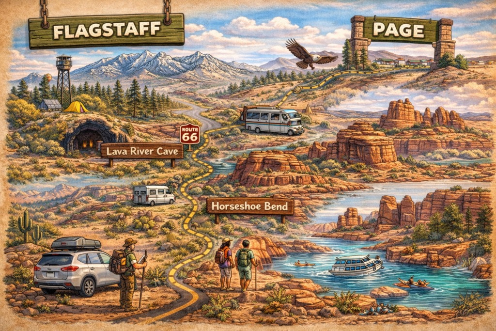
Day 4: Flagstaff to Page
Morning: Scenic Drive to Page
8-9 AM: Depart Flagstaff
The drive from Flagstaff to Page covers approximately 135 miles and takes about 2.5 hours via Highway 89 North. This route offers spectacular scenery including the Painted Desert, Navajo Nation lands, and dramatic elevation changes.
The Drive: 135 miles, 2.5 hours minimum (allow 3-4 hours with stops)
Route Description:
Highway 89 North begins in Flagstaff and travels through diverse landscapes:
- Ponderosa pine forests (first 20 miles)
- Volcanic cinder cones and lava fields (Sunset Crater area)
- Open high desert grasslands
- Painted Desert vistas
- Dramatic cliff formations
- Colorado River approach near Page
Notable Stops En Route:
Sunset Crater Volcano National Monument (Optional, 30-45 minutes):
GPS: Forest Road 545, 12 miles north of Flagstaff
A cinder cone volcano that erupted around 1085 AD, creating a dramatic landscape of lava flows and volcanic features.
- Entry Fee: $25 per vehicle (valid 7 days, also covers Wupatki National Monument)
- Time Needed: 1-1.5 hours for Lava Flow Trail and visitor center
- Trail: Lava Flow Trail, 1-mile loop through solidified lava field
Wupatki National Monument (Optional, 45-60 minutes):
GPS: Continue north on Forest Road 545 to Highway 89
Ancient pueblos built by ancestral Puebloan people approximately 900 years ago. Multiple ruins accessible via short trails from parking areas.
- Entry Fee: Covered by Sunset Crater ticket ($25)
- Time Needed: 1-2 hours depending on how many ruins you visit
- Best Site: Wupatki Pueblo, largest and most impressive ruin
PRO TIP: If you have time and interest in archaeology or volcanoes, the Sunset Crater/Wupatki loop is absolutely worth the 2-3 hour detour. However, this pushes your Page arrival to early afternoon. Consider saving these for a future trip if you want maximum time in Page.
Cameron Trading Post (Recommended Quick Stop):
GPS: 466 US-89, Cameron, AZ 86020
Historic trading post and restaurant approximately 55 miles north of Flagstaff. Excellent bathrooms, gas station, Native American arts and crafts gallery, and restaurant with Navajo-inspired cuisine.
- Perfect for: Gas, bathroom break, lunch, souvenir shopping
- Time Needed: 20-45 minutes (longer if eating lunch)
- Restaurant Budget: $12-18 per person
- Gallery: Free to browse, high-quality (but pricey) Native American jewelry, rugs, pottery
The suspension bridge behind the trading post crosses the Little Colorado River gorge—worth a quick photo stop.
Late Morning/Midday: Arrival in Page (11 AM-12 PM)
First Impressions of Page:
Page sits on a plateau overlooking Glen Canyon and Lake Powell, created in the 1950s to house workers building Glen Canyon Dam. The town serves as the gateway to extraordinary natural attractions including Horseshoe Bend, Antelope Canyon, and Lake Powell.
Check-In & Lunch:
Most Page hotels allow early check-in if rooms are ready, or will hold luggage while you explore. After checking accommodation, grab lunch before afternoon adventures.
Lunch Options in Page:
Ranch House Grille:
American comfort food with generous portions. Try the Navajo taco or green chili burger. Budget: $12-18 per person.
Big John’s Texas BBQ:
Authentic smoked meats, hearty portions. Budget: $13-17 per person.
El Tapatio:
Solid Mexican food, quick service, affordable. Budget: $10-15 per person.
Safeway Deli:
Grab sandwiches and head to scenic lunch spot. Budget: $8-12 per person.
Afternoon: Horseshoe Bend
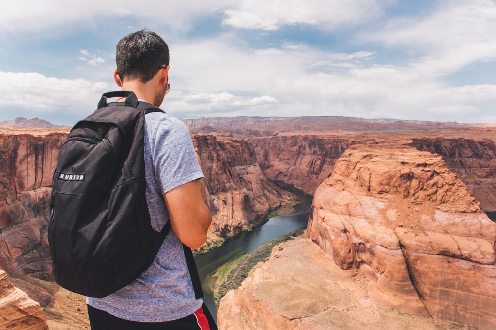
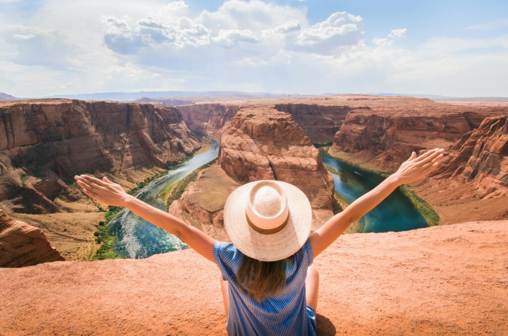
1-3 PM: Horseshoe Bend Overlook
GPS: Horseshoe Bend Trailhead, US-89, Page, AZ 86040
Horseshoe Bend ranks among the most photographed natural features in the American Southwest—a dramatic 270-degree curve in the Colorado River carved 1,000 feet below the rim.
Trail Details:
- Distance: 1.5 miles roundtrip
- Difficulty: Moderate (mostly flat but exposed, sandy trail)
- Elevation Change: Minimal (slight descent to overlook)
- Time Needed: 1-1.5 hours
- Parking Fee: $10 per vehicle
- No shade whatsoever—bring water and sun protection
Safety Warnings: The overlook has no guardrails. Stay well back from the edge, especially in windy conditions. Several fatalities have occurred from falls and heat exhaustion.
Photography Tips:
PRO TIP: For the best photos, visit during golden hour (last 2 hours before sunset). Midday light creates harsh shadows and washes out colors. Wide-angle lens (16-24mm) is essential to capture the full bend. The parking lot fills completely during peak season (April-October)—arrive before 9 AM or after 5 PM to find spots easily.
Sunset brings massive crowds but spectacular light. If photographing sunset, arrive 90 minutes early to secure a spot at the rim.
Late Afternoon: Lake Powell & Glen Canyon Dam
4-5 PM: Glen Canyon Dam Overlook & Tour
GPS: Glen Canyon Dam, US-89, Page, AZ 86040
Glen Canyon Dam impounds the Colorado River, creating Lake Powell—America’s second-largest reservoir. The dam visitor center offers self-guided tours and viewpoints.
What to See:
- Carl Hayden Visitor Center: Free admission, exhibits on dam construction and Colorado River
- Dam walking tour: Self-guided walk across the dam (stunning views)
- Guided dam tours: $5 per person, 45 minutes, includes walking inside the dam (check current availability—tours suspended periodically)
Time Needed: 45 minutes to 1.5 hours
Lake Powell Overlooks:
Several free overlooks provide stunning views of Lake Powell’s blue waters contrasting with red rock formations:
- Wahweap Overlook: Short drive from Page, sunset views
- Lone Rock Beach: Drive-on beach access (day-use $25 or free with annual pass)
Evening: Sunset & Dinner
Sunset at Horseshoe Bend OR Wahweap Overlook:
If you skipped Horseshoe Bend earlier, sunset is spectacular (expect crowds). Alternative: Wahweap Overlook offers beautiful Lake Powell sunset views with fewer people.
Dinner in Page:
Blue Buddha Sushi:
Surprisingly good sushi in desert Arizona. Fresh fish, creative rolls. Budget: $18-25 per person.
Bonkers Restaurant:
Eclectic menu, local favorite, craft beers. Budget: $15-22 per person.
Ken’s Old West Restaurant:
Western-themed steakhouse, hearty portions. Budget: $20-30 per person.
Where to Stay: Night 4
Budget Options:
- Days Inn Page: $85-110/night, basic amenities
- Quality Inn at Lake Powell: $95-120/night, outdoor pool
- Super 8 by Wyndham: $80-105/night, simple rooms
Mid-Range:
- La Quinta Inn & Suites: $110-145/night, modern, comfortable
- Hampton Inn Page: $130-165/night, includes breakfast, pool
- Courtyard by Marriott: $140-180/night, lake views available
Higher-End:
- Lake Powell Resort: $180-250/night, marina location, full-service resort
- Amangiri (splurge): $2,000+/night, ultra-luxury desert resort 30 minutes from Page
Camping:
- Lone Rock Beach Campground: $25/night, primitive camping on beach
- Wahweap Campground: $40-55/night, developed sites with hookups
Day 5: Page Exploration & Return to Phoenix
Morning: Slot Canyon Adventure
6-10 AM: Choose Your Canyon Experience
This is why we included Page in your Northern Arizona road trip—the slot canyons surrounding Page rival any natural wonders in the Southwest. You have several options depending on budget and adventure level.
OPTION A: Free/Budget Slot Canyons (Recommended)
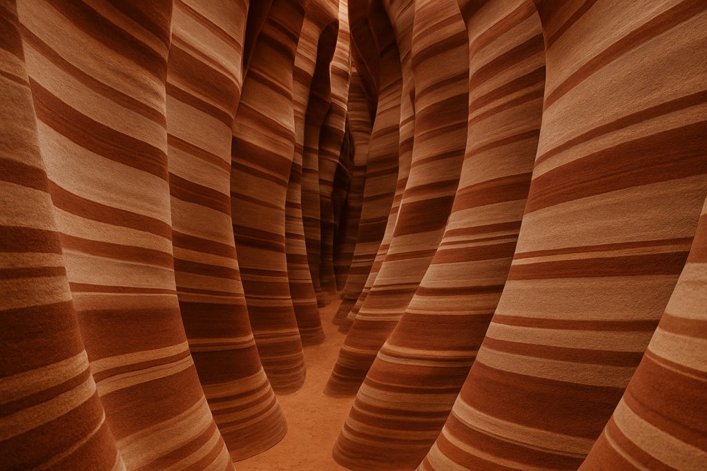
Explore the free or low-cost slot canyons we detailed in our comprehensive guide: 7 Secret Slot Canyons Near Page Arizona
Top Choices for Morning Exploration:
- Waterholes Canyon: Free, dramatic formations, 2-3 hour adventure
- Wire Pass to Buckskin Gulch: $6 permit, spectacular slot canyon hiking
- Canyon X: $45-65 guided tour, Antelope Canyon alternative with smaller groups
OPTION B: Antelope Canyon Guided Tour (Premium Experience)
If budget allows, Upper or Lower Antelope Canyon offers world-class slot canyon experiences:
- Upper Antelope: $100-140 per person, famous light beams (summer only, 10 AM-1 PM)
- Lower Antelope: $80-100 per person, stairs and narrow passages, slightly less crowded
Book tours months in advance for peak season. Early morning or late afternoon tours offer better photography and slightly lower prices than midday light beam tours.
Our Recommendation:
Save the $100+ and explore Waterholes Canyon or Canyon X for equally stunning (and more adventurous) experiences with genuine solitude.
Late Morning: Final Page Activities (10 AM-12 PM)
Depending on Your Canyon Timing:
Antelope Point Marina (If time permits):
- Rent kayaks or stand-up paddleboards ($50-75 per day)
- Short lake cruise options
- Beautiful views of Lake Powell
Page Overlook: Quick viewpoint offering panoramic views of Page, Lake Powell, and surrounding landscapes. Free, 5-minute stop.
Last-minute photo ops: Revisit Horseshoe Bend if morning light appeals (much less crowded than sunset), or explore any viewpoints you missed yesterday.
Midday: Begin Return Journey to Phoenix
12-1 PM: Lunch & Departure
Lunch Options Before Leaving:
- Grab sandwiches from Safeway for road snacks
- Quick lunch at any Page restaurant (30-45 minutes)
- Pack cooler if you brought one—picnic en route
The Return Drive: 280 miles, approximately 4.5 hours (direct route)
Route Option 1: Direct Return via Highway 89 & I-17 (Fastest)
Total Time: 4.5 hours without stops
From Page, take Highway 89 South all the way to I-17, then I-17 South to Phoenix. This is the most straightforward route, following the same highways you took northbound.
Strategic Stops:
- Cameron Trading Post: Bathroom/gas break (same location as Day 4)
- Sunset Point Rest Area: Final break before Phoenix (I-17 mile marker 252)
Arrival in Phoenix: Approximately 5:30-6:30 PM depending on departure time and stops
Route Option 2: Scenic Return via Prescott (Adds 45-60 minutes)
Total Time: 5.5-6 hours with stops
For variety and additional scenery, return via Highway 89A through Prescott. This route adds time but offers completely different landscapes and opportunities for a final Northern Arizona experience.
Route:
- Highway 89 South from Page to Highway 89A junction
- Highway 89A South through Prescott
- Continue on 89A/Highway 69 to I-17 South
- I-17 South to Phoenix
Advantages:
- Scenic mountain driving through Prescott National Forest
- Opportunity to explore Prescott (add 1-2 hours for downtown visit)
- Less monotonous than retracing your route
- Possible stop at Jerome (add 1 hour for exploration)
Prescott Quick Stop Ideas:
- Downtown Prescott stroll (30-45 minutes)
- Whiskey Row historic district
- Watson Lake photos
- Coffee/snack break at local café
Jerome Quick Stop: If you have energy and time, Jerome offers fascinating ghost town/art colony atmosphere. See our Arizona Ghost Towns guide for details.
Evening: Arrival Home
Arrive Phoenix: 6-8 PM depending on route choice and stops
Final Pro Tips for the Drive:
PRO TIP: The drive from Page back to Phoenix loses 3,200 feet of elevation. Your ears will pop frequently—chew gum or yawn regularly to equalize pressure. Fill gas tank in Page or Cameron—limited services for long stretches of Highway 89.
If driving at sunset, the light on the San Francisco Peaks (visible from Highway 89 South) creates spectacular photography opportunities. Multiple pullouts allow safe stops.
Alternative Routes & Extensions
3 Day Weekend Version (Condensed)
Day 1: Phoenix → Sedona (overnight Sedona)
- Bell Rock hike, sunset at Airport Mesa
Day 2: Sedona → Flagstaff (overnight Flagstaff)
- Oak Creek Canyon drive, West Fork hike
Day 3: Flagstaff → Phoenix (direct return)
- Optional morning at Lowell Observatory or Walnut Canyon
Total Distance: Approximately 300 miles
7-Day Extended Northern Arizona Loop
Day 1: Phoenix → Sedona (overnight Sedona)
Day 2: Full day Sedona hiking (Cathedral Rock, Devil’s Bridge) (overnight Sedona)
Day 3: Sedona → Flagstaff → Grand Canyon (overnight Grand Canyon)
Day 4: Full day Grand Canyon exploration (overnight Grand Canyon or Flagstaff)
Day 5: Flagstaff → Page (overnight Page)
Day 6: Full day Page slot canyons and Lake Powell (overnight Page)
Day 7: Page → Monument Valley → Phoenix (long day) OR Page → Prescott → Phoenix
Total Distance: Approximately 950-1,100 miles depending on Monument Valley inclusion
Add-On Destination Ideas
Monument Valley (from Page):
125 miles, 2.5 hours each way—iconic Navajo Tribal Park with towering sandstone buttes. Add full day or overnight.
Walnut Canyon National Monument (near Flagstaff):
Cliff dwellings accessible via steep trail descending 185 feet into canyon. 1-2 hours, $15 entry.
Petrified Forest National Park:
130 miles from Flagstaff via I-40 East—ancient fossilized trees and Painted Desert landscapes. Add full day.
Havasu Falls:
Remote, permit-required waterfall oasis on Havasupai tribal lands. Requires overnight backpacking permit (extremely difficult to obtain).
Total Trip Budget Breakdown
Here’s a realistic budget for the 5-day Northern Arizona road trip for two people sharing all costs:
Transportation Costs
Gas:
- Total Distance: ~750 miles
- Average Fuel Economy: 25 mpg
- Gas Needed: 30 gallons
- Cost at $3.50/gallon: $105
Vehicle Wear: Minimal for well-maintained vehicle
Accommodation Costs (4 Nights)
Budget Option:
- Night 1 (Sedona): $100-120
- Night 2 (Flagstaff): $90-110
- Night 3 (Flagstaff): $90-110
- Night 4 (Page): $95-120
- Total: $375-460 ($187-230 per person)
Mid-Range Option:
- Night 1 (Sedona): $150-180
- Nights 2-3 (Flagstaff): $140-160 each
- Night 4 (Page): $130-160
- Total: $560-660 ($280-330 per person)
Camping Option:
- 4 nights at $25-30/night average
- Total: $100-120 ($50-60 per person)
Food Costs (5 Days)
Budget Approach:
Grocery store breakfast and lunch, one affordable restaurant dinner daily
- Total: $200-250 ($100-125 per person)
Mid-Range Approach:
Mix of restaurants and groceries, occasional nice dinners
- Total: $350-450 ($175-225 per person)
Attraction Entry Fees
National Park/Monument Fees:
- Red Rock Pass (Sedona, 7-day): $15
- Grand Canyon National Park: $35
OR America the Beautiful Pass: $80 (covers both plus others)
Optional Paid Attractions:
- Lowell Observatory: $18 per person
- Slide Rock State Park: $10-20
- Antelope Canyon (if chosen): $80-140 per person
- Various museum fees: $5-15 per person
Minimum Entry Fees: $50-80
With Optional Attractions: $100-250+ per person
Total Trip Cost Summary
Ultra-Budget (Camping, Groceries, Free Activities):
- $450-600 per person for entire 5-day trip
Budget-Conscious (Motels, Mixed Dining, Select Paid Activities):
- $650-850 per person
Mid-Range (Comfortable Hotels, Restaurant Meals, Multiple Attractions):
- $900-1,200 per person
Premium (Nice Hotels, Antelope Canyon, Fine Dining):
- $1,400-1,800+ per person
Money-Saving Strategies
- Stay in alternative towns: Village of Oak Creek instead of Sedona ($40-60/night savings)
- Pack cooler with groceries: Saves $100-150 per person on food
- Visit free attractions: Most hiking and viewpoints are free
- Travel off-season: October-April (excluding holidays) offers 30-50% lower hotel rates
- America the Beautiful Pass: $80 covers Grand Canyon, potential other parks if extending trip
Best Time for Northern Arizona Road Trips
Timing significantly impacts your Northern Arizona road trip experience:
Spring (March-May): Excellent ⭐⭐⭐⭐⭐
Pros:
- Ideal temperatures (60-80°F across most elevations)
- Wildflowers bloom (especially after wet winters)
- Oak Creek flowing strong
- Longer daylight hours
- Grand Canyon accessible without extreme crowds
Cons:
- Spring break (mid-March) brings heavy crowds and higher prices
- Some higher elevation areas may have lingering snow (early March)
- Hotels book far in advance for popular weekends
Best Months: April and May
Summer (June-August): Challenging ⭐⭐
Pros:
- Flagstaff comfortable (70-80°F)
- Monsoon storms create dramatic skies (July-August)
- Longer daylight hours
- Antelope Canyon light beams (summer only)
Cons:
- Extreme heat in Phoenix, Sedona (95-115°F)
- Flash flood danger during monsoons
- Most expensive hotel season
- Extremely crowded at all major attractions
Strategy: Focus on Flagstaff and Page, minimize time in Sedona heat, start hikes at sunrise
Fall (September-November): Peak Season ⭐⭐⭐⭐⭐
Pros:
- Perfect temperatures across all elevations
- Fall colors in Oak Creek Canyon (late September-October)
- Generally stable weather (monsoons end mid-September)
- Comfortable hiking conditions everywhere
- Stunning photography light
Cons:
- Most expensive season (September-October)
- Heavy crowds continue through October
- Books far in advance
- Shorter daylight hours (November)
Best Months: October and early November
Winter (December-February): Budget Season ⭐⭐⭐
Pros:
- Lowest hotel rates (30-50% off peak season)
- Minimal crowds except holidays
- Grand Canyon snow creates magical scenery
- Flagstaff skiing opportunities
- Crisp, clear days
Cons:
- Cold temperatures (Flagstaff can hit 0°F at night)
- Snow may close roads temporarily
- Shorter daylight hours
- Some attractions reduce hours or close
- Oak Creek much colder for swimming
Best Months: February (warming up, still quiet)
Essential Packing List {#packing-list}
Clothing & Footwear
Layering System (Critical for Elevation Changes):
- Light base layers
- Fleece or down mid-layer
- Waterproof shell jacket
- 3-4 complete outfits
- Comfortable hiking pants/shorts
- Hiking boots (broken in!)
- Casual shoes for restaurants
- Sandals or water shoes (Oak Creek swimming)
- Hat and sunglasses
- Swimsuit
Seasonal Additions:
- Winter: Gloves, beanie, warm jacket, thermal underwear
- Summer: Extra sun protection, cooling towels, light fabrics
Car & Navigation
- Phone car charger
- Portable battery pack
- Downloaded offline maps (AllTrails, Google Maps)
- Physical Arizona road atlas (backup for no service areas)
- Sunshade for windshield (parking in sun)
Outdoor Gear
- Day pack (20-30L)
- Reusable water bottles (2L minimum per person)
- Hiking poles (optional but helpful)
- Camera and extra batteries
- Binoculars for wildlife
- Headlamp or flashlight
- Sunscreen SPF 50+
- Lip balm with SPF
- Insect repellent
Food & Cooler
- Cooler with ice
- Reusable bags for groceries
- Snacks (trail mix, bars, jerky)
- Breakfast supplies
- Lunch fixings
- Drinks
- Utensils, paper plates, napkins
- Trash bags
First Aid & Safety
- Basic first aid kit
- Blister treatment
- Pain relievers
- Any personal medications
- Allergy medication
- Hand sanitizer
- Wet wipes
Documents & Money
- Driver’s license
- Credit cards + cash ($100-200)
- Hotel confirmations
- National Park passes (if purchased in advance)
- Emergency contact list
Nice-to-Have Items
- Camping chairs (for picnics and sunset viewing)
- Bluetooth speaker
- Books or audiobooks for driving
- Travel games
- Hammock (Oak Creek Canyon, Flagstaff forests)
- Telescope or star chart (dark sky viewing)
Road Trip Safety & Tips
Driving Safety
Elevation Changes:
You’ll gain and lose significant elevation. Ears will pop frequently—chew gum, yawn, or swallow to equalize pressure. Vehicles may experience reduced power at higher elevations.
Wildlife Crossings:
Deer and elk are common, especially at dawn and dusk. Drive cautiously through forested areas, particularly Highway 89A through Oak Creek Canyon and routes around Flagstaff.
Weather Awareness:
Check forecasts for all destinations before departure. Mountain weather changes rapidly—afternoon thunderstorms develop quickly in summer. Flash floods can occur in slot canyons and washes miles from actual rainfall.
Gas Strategy:
Fill up in major towns (Phoenix, Sedona, Flagstaff, Page). Some stretches offer limited services. Don’t let tank drop below quarter-full.
Health Considerations
Altitude Adjustment:
Flagstaff sits at 7,000 feet. Some people experience mild altitude sickness (headache, fatigue, shortness of breath). Stay hydrated, avoid alcohol first night, take it easy initially.
Hydration:
Arizona’s dry climate causes rapid dehydration. Drink water constantly—at least 3-4 liters per person daily when hiking. Symptoms of dehydration include headache, fatigue, dizziness.
Sun Protection:
UV radiation is intense at higher elevations. Reapply sunscreen every 2 hours when outdoors. Wear hats and sunglasses. Shade is limited on many trails.
Navigation & Communication
Cell Service Gaps:
Many areas have zero cell service (Oak Creek Canyon, Highway 89 between Flagstaff and Page, slot canyons). Download offline maps before trip. Tell someone your itinerary.
GPS Limitations:
GPS sometimes routes incorrectly on rural roads. Compare GPS directions with physical maps. Don’t blindly trust GPS in remote areas.
Emergency Preparedness
What to Keep in Vehicle:
- Spare tire (check condition before trip)
- Jack and tire tools
- Jumper cables
- Basic toolkit
- Flashlight
- Extra water (1 gallon minimum)
- Emergency blanket
- Road flares or reflective triangles
- Phone charger
If You Break Down:
- Pull safely off road if possible
- Turn on hazard lights
- Stay with vehicle unless in immediate danger
- Call for help when cell service available
- Don’t attempt repairs on busy highways
Hiking Safety
Know Your Limits:
Choose hikes appropriate for your fitness level. Going down is always easier than coming back up (especially at Grand Canyon).
Leave No Trace:
Pack out all trash, stay on established trails, don’t disturb wildlife or natural features.
Wildlife Encounters:
Never approach or feed wildlife. Give elk and deer wide berth. Rattlesnakes are present—watch where you step and place hands.
Frequently Asked Questions
How many days do you need for a Northern Arizona road trip?
We recommend minimum 5 days for the complete Phoenix-Sedona-Flagstaff-Grand Canyon-Page loop. This allows adequate time at each destination without feeling rushed. A condensed 3-day version covering Phoenix-Sedona-Flagstaff works for quick weekends, while 7 days permits deeper exploration and additional destinations like Monument Valley.
Can you do Northern Arizona in winter?
Yes, with appropriate preparation. Main highways remain open year-round, though temporary closures occur during snowstorms. Flagstaff and Grand Canyon receive significant snow, creating beautiful scenery but requiring winter driving skills and proper tires. Temperatures can drop below freezing, especially at night. We actually love winter trips for solitude and dramatic snow-dusted landscapes, but summer visitors should know conditions differ dramatically.
What's the best route from Phoenix to the Grand Canyon?
The fastest route is Phoenix → Flagstaff (I-17, 2.5 hours) → Grand Canyon South Rim (Highway 64, 1.5 hours) for total 4 hours. Our recommended scenic route adds Sedona: Phoenix → Sedona (2 hours) → Oak Creek Canyon → Flagstaff (1 hour) → Grand Canyon (1.5 hours), spreading the drive across 2 days with overnight in Sedona and/or Flagstaff.
Is Highway 89A through Oak Creek Canyon dangerous?
No, but it requires attention. The road features switchbacks, narrow sections, and limited pullouts. Drive slowly, watch for oncoming traffic on curves, and use pullouts to let faster traffic pass. RVs over 40 feet should avoid this route. The scenery is spectacular—just stay focused on driving.
Do I need 4WD or high-clearance for this trip?
No, standard passenger vehicles handle all main routes perfectly. High-clearance helps for dirt road detours and dispersed camping areas, but isn’t necessary for the core itinerary. If exploring remote slot canyons or backcountry camping, consult specific trail reports for vehicle requirements.
Can you swim in Oak Creek?
Yes! Oak Creek maintains year-round flow, though water temperatures rarely exceed 60-65°F even in summer. Popular swimming areas include Slide Rock State Park, Grasshopper Point, and numerous pullouts along Highway 89A. Water is cold but refreshing, especially on hot days.
Is the Grand Canyon crowded?
Yes, especially May-September and holiday weekends. South Rim receives 5+ million visitors annually. Mitigate crowds by arriving very early (sunrise), visiting during shoulder seasons (April, October-November), or exploring less-visited areas like Desert View Drive. Weekdays are significantly less crowded than weekends.
How much does the Northern Arizona road trip cost?
Budget travelers can complete the 5-day trip for $450-600 per person including camping, groceries, gas, and basic entry fees. Mid-range travelers spending on hotels, restaurant meals, and attractions should budget $900-1,200 per person. Premium experiences including nice hotels, Antelope Canyon tours, and fine dining run $1,400-1,800+ per person.
Should I book hotels in advance?
Absolutely, especially for spring and fall travel. Sedona, Flagstaff, and Page hotels book months ahead during peak season. Winter and summer (except holidays) offer more flexibility for last-minute bookings. We always book accommodations when planning rather than hoping for availability.
What if I only have 3 days?
Focus on Phoenix-Sedona-Flagstaff triangle, skipping Page and Grand Canyon. Spend one night in Sedona, one in Flagstaff, and explore Oak Creek Canyon, red rock hiking, and downtown Flagstaff highlights. Alternatively, do Phoenix-Flagstaff-Grand Canyon day trip-Phoenix, skipping Sedona and Page entirely.
Your Northern Arizona Adventure Starts Now
This 5-day Northern Arizona road trip itinerary delivers the perfect balance of iconic landmarks and hidden discoveries, comfortable pacing and adventurous exploration, budget consciousness and memorable experiences. From Sedona’s crimson cliffs to Flagstaff’s alpine forests, from the Grand Canyon’s incomparable grandeur to Page’s otherworldly slot canyons, this journey showcases why Northern Arizona captivates millions of visitors from around the world.
The route we’ve outlined provides a tested framework, but the best road trips always include spontaneous detours, unexpected discoveries, and personal touches that make the journey uniquely yours. Use this guide as your foundation, then customize based on your interests, pace, and travel style.
Whether you’re seeking outdoor adventure, photography opportunities, cultural immersion, or simply escape from everyday routines, Northern Arizona delivers experiences that linger long after you’ve returned home. The landscapes are dramatic, the hiking is world-class, the small towns are charming, and the memories will last a lifetime.
Ready to start planning your Northern Arizona road trip?
Download our free Northern Arizona Road Trip Planning Kit including detailed maps, printable day-by-day checklists, budget worksheets, and GPS coordinates for all featured destinations.
Pack your bags, fill your gas tank, and point your compass north—Northern Arizona’s wonders are waiting to be explored.
Have you completed a Northern Arizona road trip? What were your favorite stops and discoveries? Share your experiences and tips in the comments below!
About the Author:
The GetawayArizona team has logged thousands of miles exploring Northern Arizona’s highways and backroads, testing routes and discovering hidden treasures that transform good road trips into unforgettable adventures. As Phoenix-based travel writers and outdoor enthusiasts, we specialize in creating detailed itineraries that balance iconic attractions with off-the-beaten-path discoveries, always focused on helping travelers experience Arizona’s best. Our combined experience includes dozens of Northern Arizona road trips across all seasons, extensive knowledge of regional accommodations and dining, and genuine passion for sharing Arizona’s incredible diversity.
Related Northern Arizona Guides:
- 7 Secret Slot Canyons Near Page Arizona (That Aren’t Antelope Canyon)
- 15 Affordable Weekend Getaways from Phoenix Under $200
- Arizona Hot Springs Guide: 8 Natural Thermal Pools You Can Hike To
Last Updated: November 2025
This post contains affiliate links for accommodations, tours, and travel services. We earn a small commission at no extra cost to you, helping us create more free Arizona travel content. All recommendations are based on our genuine experiences and extensive testing.
Table of Contents
Toggle